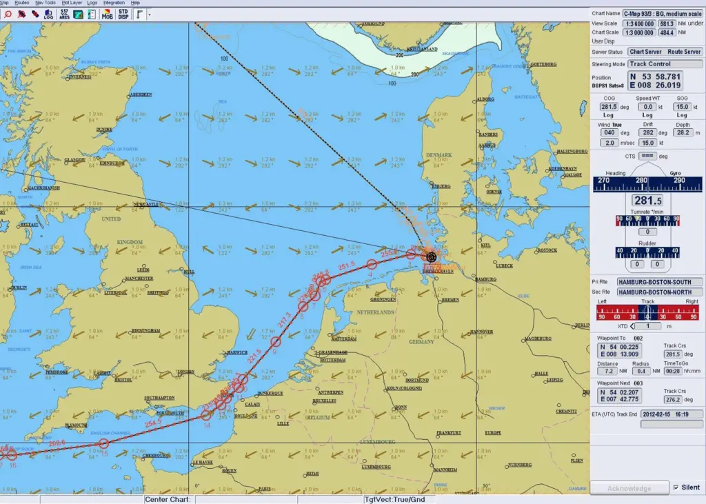
Taking the special needs of navigation into consideration, the layer was developed in close cooperation with meteorological experts of the German sea weather provider WetterWelt.
With the new feature, Raytheon Anschütz combines sea chart and weather chart in one display. All weather parameters, which are important for navigation, are presented as values or symbols on a separate layer and can be switched on and off at any time. The system can show all available weather forecasts for the next days, which is a great help for route planning with regard to safety, travel comfort and fuel consumption. In addition to the current weather conditions, the weather forecast for the next few days can be played as an animation.
The parameters which can be displayed include the mean wind with direction and speed as well as gusts, wave height, wave direction and swell, period intervals of waves and swell, current, air pressure, weather conditions and air temperature. The navigator can flexibly define which of the data he wants to have displayed in which situation and which limits he would like to set. If individual weather values exceed the preset limits, the values are shown graphically as weather warnings.
“The consideration of weather data is becoming more and more important for the shipping industry. Wind and waves or weather conditions such as fog have a direct influence on safety. Wind and waves, swell and currents have a direct influence on fuel consumption and all together influence the travel speed and prompt arrival at the destination harbour“, said Thomas Wolter, product manager at Raytheon Anschütz.
“The Gulf or Canary Streams move at about 1 to 1.5 knots, or 24 to 36 sm per day. Even at a relatively slight decrease in its own speed, the engine requires significantly less fuel, which at today’s bunker prices has a great effect on the cost.”
The Synapsis ECDIS imports the weather data via a standardized GRIB-file from a weather data provider. Customers can choose from which provider these data are to be taken. For this, free weather subscriptions are available which offer some basic parameters, but sea weather reports from professional weather service providers such as WetterWelt are also available. The data packages of the professional providers contain complete sea weather information and range in size from 25kb for the Baltic Sea to 500kb for the complete North Atlantic. The data can be imported into the ECDIS by download or email either directly or via a USB stick. Free weather data usually contains less information but at the same time much larger amounts of data.
In order to fulfill the regulations regarding the manufacturer-specific ECDIS training, Raytheon Anschütz, together with the E-learning specialist Safebridge, offers their customers complete online training. Navigators can take the training at any time via any internet connection and obtain the necessary certificate before they go on board ship.