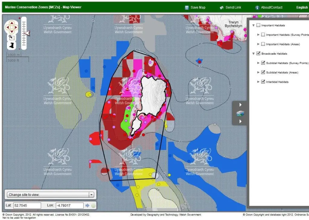
The application allows online users to see the ecological basis for 10 potential MCZ options. The OGC-compliant web map service (WMS) is the first live application since emapsite announced a new partnership with OceanWise earlier this year.
James Cutler, emapsite CEO, said: “We’ve taken the vector data and styled, shaded and served it according to the customer’s specifications. We created a coloured background WMS for internal GIS visualisation and data processing and a greyscale WMS version for use within the citizen-facing data viewer. Both versions are designed to optimise visualisation of the data at the ‘land-sea interface’, or coast, and be at a map scale to deliver the optimum level of data. It’s a prime example of a cost-effective web mapping solution that supports internal and external communications.”
By visiting the map viewer at http://data.wales.gov.uk/apps/marine/ users can navigate the sites and access a range of subtidal and intertidal habitat information.
The overall aim is to help realise the vision for clean, healthy, safe, productive and biologically diverse seas.