



Marine objectives await launch into orbit
A satellite will be used by maritime authorities as an additional means of ensuring safety at sea in the High North.
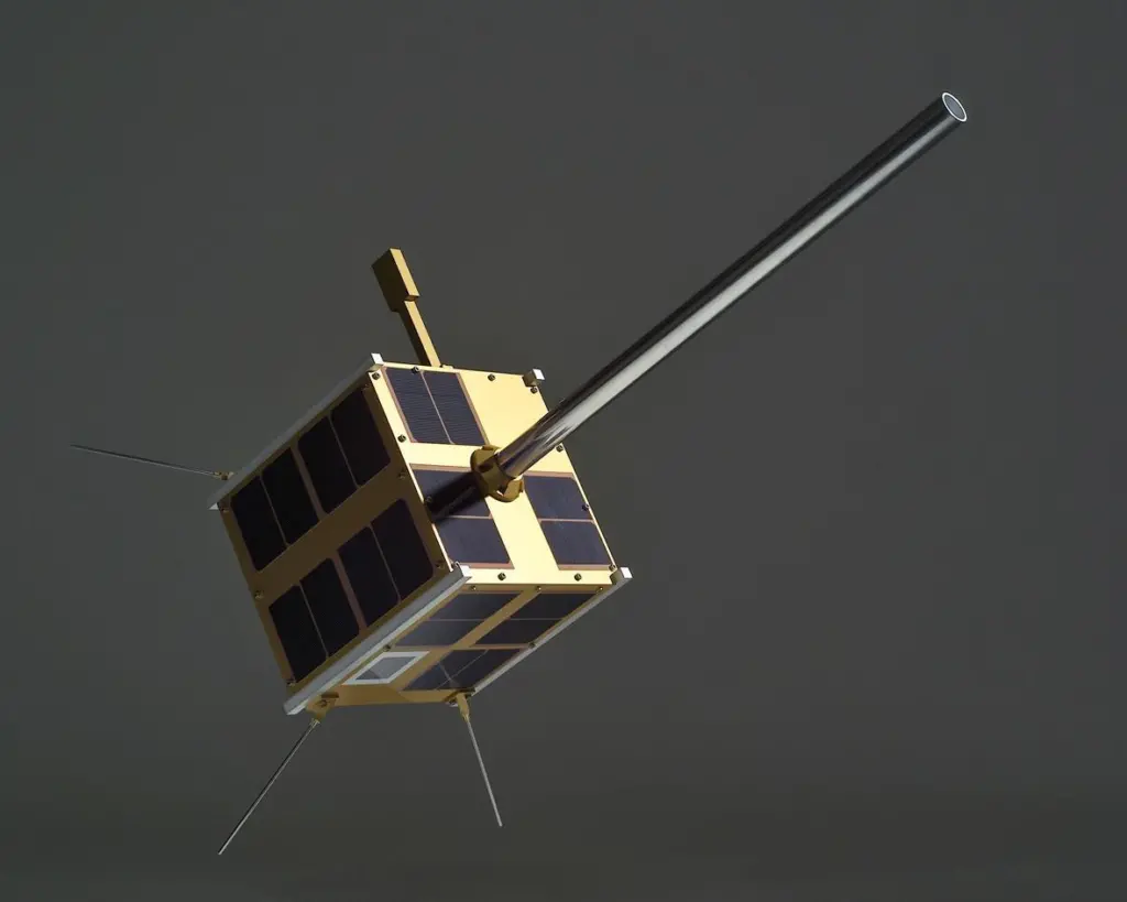
The Norwegian satellite, AISSat-1, was delayed at the time of writing from its launch in India following technical difficulties with the rocket. Marianne Moen of the Norwegain Space Centre told MJ that the satellite should be ready fo launch within weeks.
AISSat-1 is a demonstrator and experimental satellite carrying equipment for reception and relaying AIS signals. Presently communication is line of sight, allowing countries to monitor ships within about 50km of their shores. A space based platform allows for looking at much larger areas, especially in regions that are difficult to monitor through more traditional base station means.
The satellite is equipped with technology developed in a joint effort by the Norwegian Defence Research Establishment (FFI), Kongsberg Seatex AS, the Norwegian Coastal Administration and the Norwegian Space Centre. The satellite is funded by the Norwegian Space Centre. The Space Flight Laboratory (SFL) is providing the spacecraft platform and the AIS VHF antenna, as well as spacecraft level management, systems engineering, assembly, integration, and test support. SFL has also been responsible for launch and commissioning on orbit, after which the spacecraft is being delivered to FFI for operations.
The 6kg satellite design is based on the Generic Nanosatellite Bus (GNB), which is basically a 20cm cube in dimension and includes a full suite of advanced capabilities. These include, beside a solar cell power system, a powerful complement of onboard computer processing systems (with a computer dedicated to payload activities) and a flexible TT&C and payload data communication system, allowing for variable and high speed data downlinks to the ground.
All passenger ships and large vessels in international traffic are required to carry the Automatic Identification System (AIS) onboard. AIS is primarily a ship collision avoidance system and is based on a range of onshore base stations with an offshore range of about 40 nautical miles. There are at present 35 base stations deployed along the Norwegian coast and all IMO nations have deployed, or are in the process of deploying, a similar chain of base stations.
The exploitation of this technology in a fully deployed system will improve the safety for ocean going vessels in the High North and around Spitzbergen. Such a system will also simplify the identification and coordination of vessels in a search and rescue situation as well as being used for monitoring of vessels carrying hazardous cargo and other environmental risk assessment situations.
Norwegian technology and industry clusters working with satellite communication are well recognised. Europe, USA and Canada have shown a keen interest in the AISSat-1 test satellite.
‘This satellite is an example of how a long term investment in Norwegian expertise leads to innovative and high technology solutions designed for Norwegian purposes’, said Minister of Trade and Industry, Trond Giske.