




MariTrace unveils tracking for small vessels
Reports of attacks on vessels in the Gulf of Aden and the Red Sea are a stark reminder of the need to ensure vessels are equipped with live tracking for safety and confidence onboard.
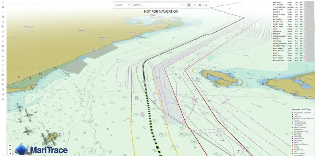
While the attacks may be intended to mark out ships with business connections to specific countries, the risks of collateral damage and the real threat to the lives of innocent people are clear across the maritime industry.
Recently, redefined vessel tracking and data intelligence for the maritime sector has hit the market, offering new and improved maritime tracking capabilities for small vessels, including workboats, tugboats, offshore support, and pilot boats.
Unlike existing commercial or merchant shipping vessel tracking devices that are only available with large fleets, Mercury – a new tracking device by global maritime intelligence firm MariTrace, – is compatible with all small vessels that have NMEA, power, and internet connection.
Mercury allows users to securely view live and historic positions of the vessel, far surpassing the tracking data usually provided by AIS alone.
Relayed in an intuitive MariTrace map interface or API, existing GPS and AIS data is securely and directly visible only to the owner of that vessel. The highly granular transmission provides a GPS position once per minute as default, with the ability to increase the frequency as required, far exceeding shoreside AIS monitoring capabilities across the current market.
Using small vessels’ network integration systems – compatible with NMEA 0183/2000 – Mercury gives customers the option to share the vessel’s positions with other authorised users, such as from pilot boats to their outbound ships, or from tugs to the vessel it’s assisting, as well as vessel insurers, security teams and crew.
Mercury has been developed with discretion in mind, designed to be concealed, compact, and easy to install. The advanced technology not only detects loss of connectivity but is designed with ultimate connectivity, caching the vessel’s position in the event of an internet drop, even when AIS data transmissions are unavailable, for automatic and on-demand downloads.
Related Articles
 OTHER NEWS
 ACCESSORIES & EQUIPMENT
 EQUIPMENT