


Hydrographic Survey – Page 35
-
 News
NewsClear as a bell despite local interference
The demonstration of a novel undersea marking device went well despite the best attempts of the local sailors.
-
 News
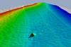
NewsFinding boxes lost from Rena wreck
A multibeam sonar is being used to good effect by hydrographic surveyors at the grounding site of the 236m cargo vessel MV Rena on the Astrolabe Reef off the coast of New Zealand.
-
News
Online ECDIS training
Ahead of new IMO ECDIS requirements next year, Hamburg based Safebridge says it will shortly introduce the first release of its new online courseware for type-specific training.
-
News
Sonardyne extends transponder range
Sonardyne of Yateley, Hampshire UK has launched the sixth generation of its best selling acoustic positioning transponder, the Wideband Sub Mini 6 (WSM6).
-
News
US Albanian surveys
Hydrographic surveys of Durres harbour and its approaches in the Adriatic Sea, Albania, are presently being completed by a US Navy Fleet Survey Team (FST) under arrangements with the Albanian government.
-
News
UKHO sells SevenCs & ChartWorld
The UK Hydrographic Office has sold SevenCs and its subsidiary, ChartWorld, to Dutch-Belgian-Trading GmbH (DBT), the maritime trading and investment company in Hamburg.
-
 News
News€2.3m Norwegian contract for Fugro OSAE
Fugro OSAE of Bremen, Germany has been awarded a €2.3m contract by the Norwegian Hydrographic Service (NHS) for surveys of a 12,000 sq/km area of the Barents Sea in the northern-most part of Norway, close to the Russian border.
-
News
Russia completes GLONASS constellation
Russia’s GLONASS satellite navigation system now has a full orbital constellation of 24 satellites following successful launch of the final unit from the Plesetsk spaceport at the beginning of October.
-
News
Norwegian ENC distribution agreement
Navtor, a newly established Norwegian e-navigation company based in Egersund near Stavanger, has signed a distribution agreement with the Norwegian Hydrographic Service’s Primar organisation for supply of its official electronic nautical charts (ENCs).
-
News
New Teledyne TSS motion sensors
Watford UK based Teledyne TSS, whose Meridian Standard and Surveyor gyrocompasses have recently been type approved by the Russian Maritime Register of Shipping, has launched a new range of motion sensors, the DMS-500 series.
-
 News
NewsSunken Guinness ship detected
High resolution images of W M Barkley, the first Guiness merchant vessel, which was sunk by a German torpedo seven miles off the coast of Dublin in 1917, have been revealed.
-
News
Calibration-free acoustic positioning
CSA International Inc, an environmental survey company working in the Gulf of Mexico, is the first organisation to purchase the new GyroUSBL calibration-free acoustic positioning system from Sonardyne International of Hampshire UK.
-
News
49th Marine Measurement Forum
Partrac, the Glasgow based marine data acquisition company specialising in oceanographic, environmental and geoscience surveys, is to host the 49th UK Marine Measurement Forum at the city’s prestigious Science Centre on Wednesday 9 November.
-
News
Monitoring study of Western Med
Researchers in the Balearic Islands and beyond will soon gain a better understanding of the environmental conditions in the Western Mediterranean Sea.
-
 News
NewsRenewables focus attention on nearshore seabed
Aspect Surveys Ltd of Irvine in Scotland has added an Inshore Boomer System to its equipment pool to survey the sub-seabed layers.
-
News
MCA contract for Netsurvey
Netsurvey of Banbury UK, now part of the Swedish MMT Group, has been awarded a multi-million pound contract by the UK Maritime & Coastguard Agency for hydrographic survey work under Lot 2 of its Civil Hydrography Programme (CHP).
-
News
New Dutch Chief Hydrographer
Captain Peter Kortenoeven, until recently a staff officer for maritime planning at NATO’s headquarters in Brussels, has been appointed Chief Hydrographer of the Royal Netherlands Navy, in succession to Captain Floor de Haan.
-
News
UTEC opens Italian subsidiary
UTEC Survey, which claims to be one of the world’s largest independent offshore survey companies with offices in Australia, Brazil, Canada, Singapore and the UK, has established an Italian presence in Naples with the formation of UTEC Survey Mediterranean Srl.
-
News
Mystery Baltic Sea find
A team from Stockholm based Ocean Explorer headed by researcher and treasure hunter Peter Lindberg has found what some are suggesting is either a crashed flying saucer or a subsea version of Stonehenge.
-
News
Offshore positioning guidelines
The former UKOOA (UK Offshore Operators Association) document, Guidelines for the Use of GPS in Offshore Surveying, has been jointly revised by the International Association of Oil & Gas Producers (OGP) and the International Marine Contractors Association (IMCA).