


All News articles – Page 824
-
 News
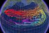
NewsTsunami debris set to hit the US
A 25 million tonne marine debris field created by the Japanese tsunami back in March currently afloat in the North Pacific is set to reach Hawaii by this winter, according to experts.
-
News
Calibration-free acoustic positioning
CSA International Inc, an environmental survey company working in the Gulf of Mexico, is the first organisation to purchase the new GyroUSBL calibration-free acoustic positioning system from Sonardyne International of Hampshire UK.
-
News
49th Marine Measurement Forum
Partrac, the Glasgow based marine data acquisition company specialising in oceanographic, environmental and geoscience surveys, is to host the 49th UK Marine Measurement Forum at the city’s prestigious Science Centre on Wednesday 9 November.
-
News
Monitoring study of Western Med
Researchers in the Balearic Islands and beyond will soon gain a better understanding of the environmental conditions in the Western Mediterranean Sea.
-
News
MCA contract for Netsurvey
Netsurvey of Banbury UK, now part of the Swedish MMT Group, has been awarded a multi-million pound contract by the UK Maritime & Coastguard Agency for hydrographic survey work under Lot 2 of its Civil Hydrography Programme (CHP).
-
News
New Dutch Chief Hydrographer
Captain Peter Kortenoeven, until recently a staff officer for maritime planning at NATO’s headquarters in Brussels, has been appointed Chief Hydrographer of the Royal Netherlands Navy, in succession to Captain Floor de Haan.
-
 News
NewsRenewables focus attention on nearshore seabed
Aspect Surveys Ltd of Irvine in Scotland has added an Inshore Boomer System to its equipment pool to survey the sub-seabed layers.
-
News
UTEC opens Italian subsidiary
UTEC Survey, which claims to be one of the world’s largest independent offshore survey companies with offices in Australia, Brazil, Canada, Singapore and the UK, has established an Italian presence in Naples with the formation of UTEC Survey Mediterranean Srl.
-
News
Offshore positioning guidelines
The former UKOOA (UK Offshore Operators Association) document, Guidelines for the Use of GPS in Offshore Surveying, has been jointly revised by the International Association of Oil & Gas Producers (OGP) and the International Marine Contractors Association (IMCA).
-
News
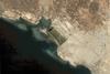
Mystery Baltic Sea find
A team from Stockholm based Ocean Explorer headed by researcher and treasure hunter Peter Lindberg has found what some are suggesting is either a crashed flying saucer or a subsea version of Stonehenge.
-
 News
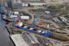
NewsWind farm wins for Birkenhead and Mostyn
RWE Innogy signed agreements earlier this month for the use of areas at Birkenhead port near Liverpool which it will use as a base port for constructing the Gwynt y Môr offshore wind farm.
-
 News
NewsD-Day survey gives hydro a wider audience
An alliance of global hydrographic organisations led by the United Kingdom Hydrographic Office (UKHO) is teaming up for a two week survey mission of an artificial harbour used during D-Day.
-
 News
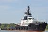
NewsTOWLINES
The anchorhandling twin screw tug Primus, built in 2004 by Mutzelfeldtwerft GmbH Cuxhaven, has recently been placed under the management of Unterweser Reederei GmbH Bremen (URAG). Owned by Primus GmbH & C0 KG, the 120 tons bollard pull tug has been under the management of Harms Offshore since its delivery ...
-
 News
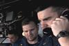
NewsTeamwork training for safer seas
“One plus one plus one doesn’t always equal three,” Captain John Wright of WrightWay Training told Maritime Journal.
-
 News
NewsMore than where the wind blows
Decisions relating to wind farm construction aren’t all about the geography or wind resource.
-
 News
NewsTyneside's renewables ‘Super Group’
A&P Tyne is part of a newly launched North East UK ‘Super Group’ formed to inform global business about how the region’s deep talent pool is positioned in a clear growth area for marine renewable energy.
-
 News
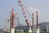
NewsNew turbine foundation installation vessel
With the wind farm industry eyeing the first examples of the crop of newbuilding turbine installation vessels being delivered, other interesting design concepts are also emerging.
-
 News
NewsNZ oilspill update
The Port of Tauranga’s annual general meeting, which took place earlier today, was somewhat taken over by an update on the Rena oil spill incident.
-
 News
NewsBeach trials begin for lifeboat launcher
The programme to bring the Royal National Lifeboat Institution’s (RNLI) new Shannon class all weather lifeboat into service reached a key milestone this summer.
-
 News
News3D port surveillance system trial underway
Milford Haven Port Authority in Wales has begun a trial of advanced C-Vu 3-dimensional VTS display software from GeoVS.