![MaritimeJournal[Seawork]](https://www.maritimejournal.com/wp-content/uploads/2026/09/MaritimeJournalSeawork.svg)


Beware of ECDIS shocks on the rocks
There’ s a good chance that groundings will increase over the coming years, says Bob Couttie, in a recent update on Maritime Accident Casebook.
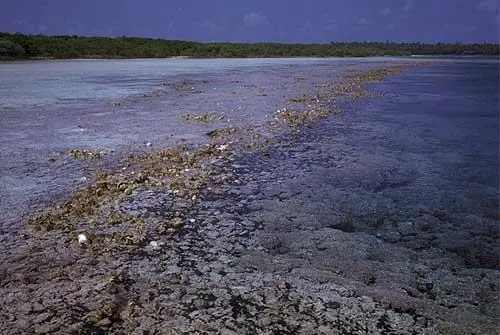
It comes about, he says, from our growing reliance on ECDIS and a false sense of security in the data on screen. Data that may, simply, have been lifted from previous charts that may not have been updated since people swung leadlines to determine depth, if surveyed at all.
This is partly because ECDIS updates charts for the major shipping routes around the world with regularity, but get off the beaten track and ships may find they are in areas that may as well have been marked ‘Here be Dragons’.
For example, the Pacific Challenger, a German flagged containership, (although not relying on ECDIS), took a reading of the shortest voyage distance from Google Earth and planned a direct course from charts and publications, ignoring the slightly longer recommended route. Unfortunately, this lead to the ship grounding hard on an uncharted reef in the South Pacific.
This is not a single, isolated incident. The jack-up barge Octopus grounded off the Orkney Islands in 2006 while under tow in waters that had not been surveyed since the 1840s. In 2007 the cruise-ship Sea Diamond hit a rock that was wrongly positioned on the official charts.
Even if the area has been accurately surveyed, charts are still occasionally not reliable since earthquakes and volcanoes can suddenly change the profile of the seabed in any seismically active area, making a nonsense of any previous depth soundings.
Bob Couttie said, ‘The chances are that such incidents will increase over the coming years as vessels, especially cruise ships, travel more and more marginal routes which are less and less well surveyed.’
He adds that since most vessels won’t have forward looking sonar, looking at the Zones of Confidence is a good idea, if planning an unfamiliar course, especially if lightly travelled, relatively shallow or in an area subject to earthquakes and volcanoes. He adds that navigators ‘might have to rummage around on your ECDIS menus to find zones of confidence and some ECDIS instruments aren’t programmed to show them at all.’
‘If an area is unsurveyed, as it was in the case of the Pacific Challenger, then it’s certainly somewhere you should think twice about, he concluded. ‘If the survey is old and growing whiskers, then you need to think carefully about how much confidence you have in what the chart tells you. Remember, the objective of the exercise is safe navigation. Always err on the side of safety.’
Related Articles
 ACCESSORIES & EQUIPMENT
 ACCESSORIES & EQUIPMENT
 ACCESSORIES & EQUIPMENT