![MaritimeJournal[Seawork]](https://www.maritimejournal.com/wp-content/uploads/2026/09/MaritimeJournalSeawork.svg)






Seafloor mapping boost
The Nippon Foundation-GEBCO Seabed 2030 Project has announced a new partnership.
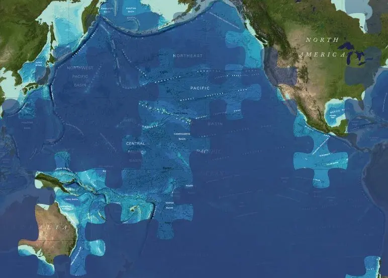
A Memorandum of Understanding (MoU) has been signed by the Seabed 2030 Project, the UK Hydrographic Office (UKHO) and Teledyne CARIS. The parties will work together to advance the effort associated with producing the definitive map of the seafloor by the year 2030.
The MoU has been announced on the first World Hydrography Day to fall within the UN Decade of Ocean Science for Sustainable Development.
Seabed 2030 project director, Jamie McMichael-Phillips, said: “As we enter the newly-launched UN Decade, but also final decade of Seabed 2030, we remain humbly aware of what we have yet to achieve – just under 80 per cent of the world’s seabed still to be mapped.”
AI tool
As part of the new agreement, the three organisations will use a new AI tool developed by Teledyne CARIS and the UKHO as part of their ADMIRALTY Maritime Data Solutions portfolio. The AI-Based Bathymetry Data Noise Cleaning Capability is thought to benefit Seabed 2030 by providing processing efficiency of incoming multibeam bathymetry dataset typical of the type to be received by the Project.
Seabed 2030 is a collaborative project between The Nippon Foundation and GEBCO to inspire the complete mapping of the world’s ocean by 2030, and to compile all bathymetric data into the freely available GEBCO Ocean Map. GEBCO is a joint project of the International Hydrographic Organization (IHO) and the Intergovernmental Oceanographic Commission (IOC), and is the only organisation with a mandate to map the entire ocean floor.
The announcement coincides with the release of the latest GEBCO Grid figure – with 20.6% of the world’s entire seabed now mapped. When Seabed 2030 was launched in 2017, only 6% of the oceans had been mapped to modern standards. The latest figure has seen a growth of 1.6% from last year’s data – an increase equating to around half the size of the US.
By Rebecca Jeffrey

Related Articles
 OFFSHORE RENEWABLES
 OTHER NEWS
 MERGERS & ACQUISITIONS