![MaritimeJournal[Seawork]](https://www.maritimejournal.com/wp-content/uploads/2026/09/MaritimeJournalSeawork.svg)






Teledyne CARIS releases latest Bathy DataBASE
Marine mapping software specialist Teledyne CARIS has released version 4.4 of its Bathy DataBASE (BDB) suite.
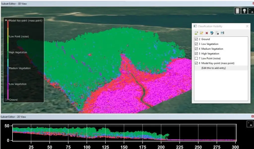
The new BASE Editor component includes new techniques for generalising bathymetry in chart compilation workflows.
While the point suppression and smoothing techniques help to minimise the manual work associated with converting survey data into chart-ready vector features. These may be used in isolation or in combination with other bathymetric feature compilation tools to produce the best possible results.
New LiDAR point cloud editing tools also enable simultaneous visual inspection, elimination of outliers and point re-classification. With the inclusion of new sample process models, BDB 4.4 also offers improved automation for S-102 and bENC overlays in one tool, thereby reducing the time required to get an automated production line operational.
By Helen Atkinson

Related Articles
 OFFSHORE RENEWABLES
 OTHER NEWS
 MERGERS & ACQUISITIONS