![MaritimeJournal[Seawork]](https://www.maritimejournal.com/wp-content/uploads/2026/09/MaritimeJournalSeawork.svg)






Osiris unveils “revolutionary” survey platform
UK-based Osiris Projects says it’s developed a dynamic remotely operated survey platform that could “revolutionise” productivity in shallow water survey and inspection applications.
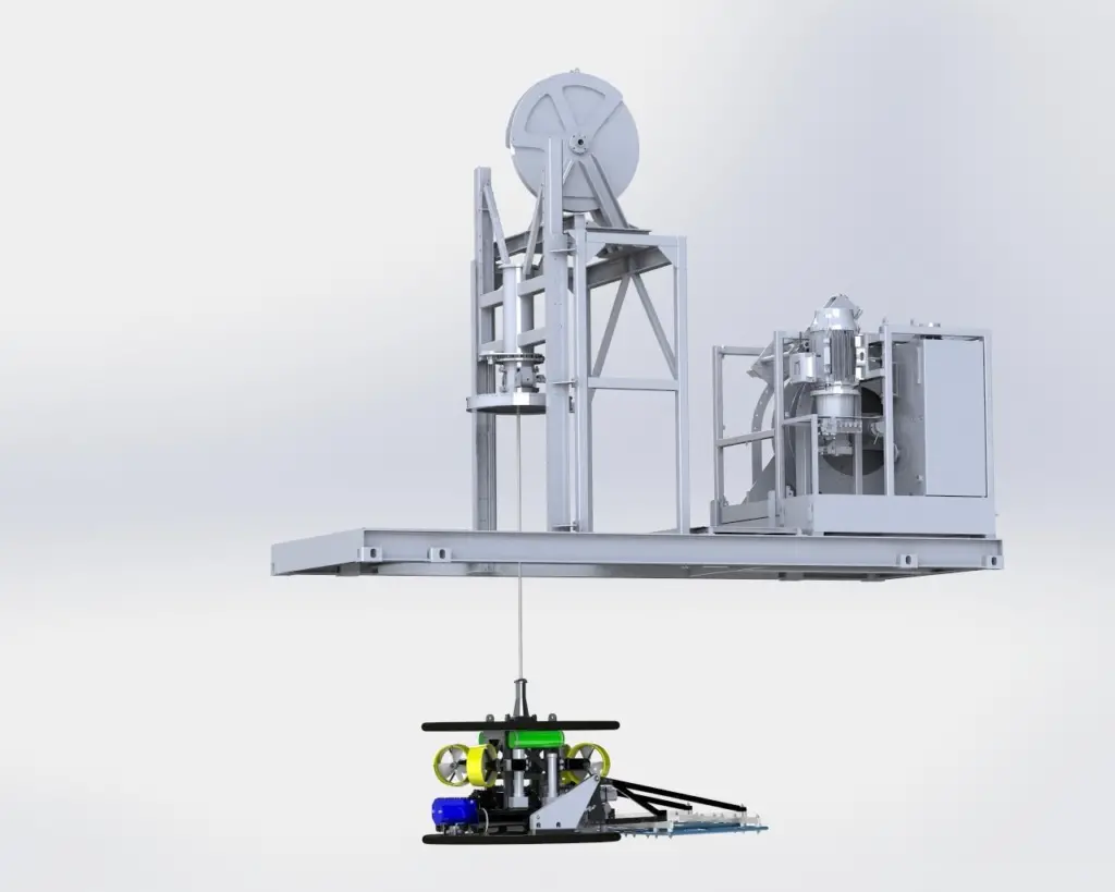
d’ROP incorporates technology and operating principles from existing ROVs, ROTVs and systems from the dredging industry. Osiris says it addresses many of the limitations of compact free-flying ROVs and seabed crawler systems, making it suitable for precision tracking operations in dynamic coastal environments.
“The system is effectively a compact high powered work class ROV platform but with all the expensive and complicated bits that we don’t need for our survey tasks stripped off; no vertical thrusters, simplified ‘hands-off’ deployment and close to fully automated operation,” said Andy McLeay, managing director.
It was initially designed for the operation from Osiris’ newly launched custom-built survey vessel Bibby Athena.
Deployed through the vessel’s moon pool, the system relies upon the support vessel for forward propulsion, a bespoke heave compensated umbilical winch and combined LARS for its vertical control with the onboard thrusters maintaining heading and fine adjustments to the lateral position. Osiris says this provides good line-keeping ability in comparison to traditional mid-size ROV systems without additional power requirements. It’s also said to provide significantly more thrust than an equivalent-sized ROV and has the ability to remain stationary, operate at slow speed for depth of burial surveying, or track at up to four knots for acoustic survey.
While d’ROP was primarily designed for precision tracking of buried cables and pipelines in coastal environments, it can accept multiple sensors at the same time.
“The beauty of this system is that it is assembled from proven components and has the flexibility to support virtually any survey sensor,” Mr McLeay added. “It can be considered as an extension of the survey vessel as it allows us to deploy our sensors where they are needed for maximum effectiveness rather than further and further away from the point of interest as water depth increases or environmental conditions deteriorate.”
By Rachael Doyle
Related Articles
 OTHER NEWS
 ACCESSORIES & EQUIPMENT
 ACCESSORIES & EQUIPMENT