![MaritimeJournal[Seawork]](https://www.maritimejournal.com/wp-content/uploads/2026/09/MaritimeJournalSeawork.svg)






Saildrone maps Gulf of Maine for NOAA
Saildrone has successfully mapped 1,500 square nautical miles in the north-central Gulf of Maine, aiding the National Oceanic and Atmospheric Administration (NOAA) in its survey of deep-sea coral habitats.
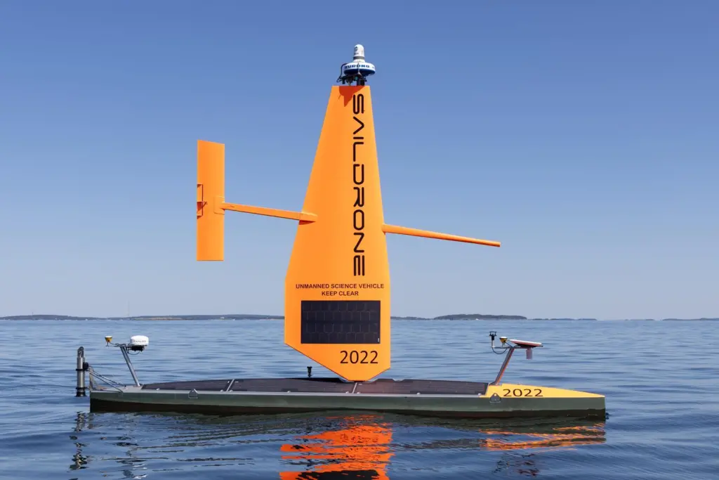
This region is a highly productive marine environment, home to diverse marine life, thriving fisheries, and unique underwater ecosystems. Despite its ecological significance, the area has been poorly mapped, particularly in its deeper waters.
“The Saildrone Voyagers are filling in a substantial gap in seafloor data in the Gulf of Maine,” said Heather Coleman, a researcher with the NOAA Fisheries Office of Habitat Conservation’s Deep Sea Coral Research and Technology Program.
“These high-resolution seafloor maps will inform future surveying and modelling efforts, as well as aid in the New England Fishery Management Council’s fishery management decisions.”
Two Saildrone Voyager uncrewed surface vehicles (USV) conducted the mapping at depths of up to 300 metres around the Jordan and Georges Basins, revealing a complex underwater landscape, shaped by glacial history and dynamic oceanographic processes.
These high-resolution maps will support visual surveys of coral and sponge habitats during NOAA cruises in 2024 and 2025.
“This is the first successful demonstration of Saildrone Voyager mapping capabilities, pushing the envelope of what is possible using autonomous systems for shallow to mid-depth EEZ mapping,” said Brian Connon, Saildrone’s vice president of Ocean Mapping.
“Its state-of-the-art Norbit multibeam echo sounder combined with near-silent operations and classification from the American Bureau of Shipping, make Saildrone’s Voyager the USV of choice for near-shore mapping.
“These capabilities can be applied for any number of missions, from habitat exploration to safety of navigation to site characterisation for offshore wind.”
Founded in 2015, Saildrone now has more than 40 USVs in its fleet. These vehicles have logged more than 42,000 days at sea and sailed over 1.3 million nautical miles.
Related Articles
 OTHER NEWS
 MARINE CIVILS
 MARINE CIVILS