
- Subscribe
Get full access to Maritime Journal content
Including the digital magazine, full news archive, podcasts, webinars and articles on innovations and current trends in the commercial marine industry.
- Expert analysis and comment
- Unlimited access to in-depth articles and premium content
- Full access to all our online archive
Alternatively REGISTER for website access and sign up for email alerts
- Industry Database
- Events
Seawork
10th - 12th June 2025Speed@Seawork
9th June 2025Seawork Conferences

The 26th edition of Europe’s largest commercial marine and workboat exhibition provides businesses the opportunity to showcase their services, equipment, vessels and supplies to an international audience. Speed@Seawork on 9th June in Cowes offers a sector specific event that showcases fast vessels operating at high speed for security interventions and Search & Rescue. "Get Set for Workboat 2050", in partnership with Seawork, Maritime Journal and The Workboat Association, is a series of conferences which deal with decarbonisation and all aspects of improving OPEX efficiencies. Visit the Seawork Website Speed@Seawork on the Seawork Website View on Seawork
Depth data management system delivered
2020-04-30T20:17:00
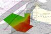
A developer of marine mapping software has delivered a depth data management system to a European hydrographic office.
This is premium content
Already a member? SIGN IN now
Register for a FREE one-month trial to continue this article
It only takes a minute to sign up for a free account, and you’ll get to enjoy:
- Weekly newsletters providing valuable news and information on the commercial marine sector
- Access to the Maritime Journal Industry Database
- Website access (3 standard news articles per month)
Get access and more free content sign up today
Does your organisation require more access? Upgrade to a subscription and enjoy unlimited news and additional features.

- Terms & Conditions
- Cookie Policy
- Privacy Policy
- © 2024 Maritime Journal
Site powered by Webvision Cloud