


Insurers use marine GIS to mitigate risk
In an exercise undertaken with the World Wildlife Fund, insurer RSA has used the latest Geographic Information Systems to show how technology could help predict the spread of an oil spill – helping both the marine industry and environmentalists predict, and minimise, the damage a spill could cause.
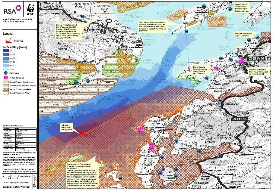
In an exercise undertaken with the World Wildlife Fund, insurer RSA has used the latest Geographic Information Systems to show how technology could help predict the spread of an oil spill – helping both the marine industry and environmentalists predict, and minimise, the damage a spill could cause.