


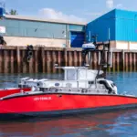



Buoys maximise wind potential
Two LiDAR buoys installed in the UK Celtic Sea will provide data to inform offshore wind developers about the best position to place wind turbines.
The LiDAR (Floating laser imaging, detection and range) systems, by French firm Akrocean, are about 60 miles offshore and will use laser technology to collect wind speed and direction, meteorological and oceanographic data.
The 5.1m x 2.4m buoys are part of Akrocean’s fleet of LiDAR and RADAR buoys, which are based on French firm GEPSTechno’s technology. The company says its systems provide several types of offshore measurement tools on stable and hybrid power platforms.
Remote supervision is also a feature.
Celtic Sea Power, which is owned by the local authority, has been tasked with the development of a Celtic Sea for Floating Offshore Wind (FLOW) initiative to generate more offshore electricity. A number of agencies, including the European Union, are also involved in the project.
Neil Farrington, Strategic Offshore Development Manager at Celtic Sea Power, said: “The data from these Floating LiDAR systems will benefit Cornwall, South Wales and the wider South West by feeding into a bank grade regional wind resource model. This model will then be validated by external experts to support investment decisions for FLOW sites across the UK Celtic Sea region. It will also help reduce the time it takes to install floating offshore wind farms”.
Related Articles
 OTHER NEWS
 SPONSOREDSTORY
 INDUSTRY NEWS