![MaritimeJournal[Seawork]](https://www.maritimejournal.com/wp-content/uploads/2026/09/MaritimeJournalSeawork.svg)






Offshore wind on the CUSP of SBP breakthrough
 Part of our special report
Autonomy at Sea · January 2026
All 10 features
Part of our special report
Autonomy at Sea · January 2026
All 10 features
As offshore wind capacity deployment continues to scale, developers need increasingly detailed characterisation of the seafloor to de-risk engineering activities such as cable route planning, landfall design and foundation installation.

Much of this work remains reliant on conventional 2D sub-bottom profiling (SBP), which provides only a narrow vertical slice through the seafloor. This can limit confidence in feature interpretation, particularly where geological complexity exists or where feature continuity must be understood laterally.
Emerging 3D sub-bottom profiling technologies address this limitation but are typically dependent on towed arrays or subsea-deployed systems. These approaches introduce operational constraints, particularly in shallow water, congested near-shore zones and environmentally or operationally sensitive landfall areas where towing is impractical or restricted.
The CUSP project, supported by the Offshore Wind Growth Partnership (OWGP), directly addresses this gap by enabling a USV-first, non-invasive 3D sub-bottom profiling capability.
The aim is to eliminate the need for towfish deployment and enable cost-effective, dependable surface-based operations. It is specifically designed to operate safely and efficiently in shallow, constrained environments that are increasingly critical to offshore wind development.
The CUSP consortium consists of:
- HydroSurv, which contributed uncrewed systems engineering and operational delivery experience
- GeoAcoustics, which brought established SBP technology and geophysical instrument expertise;
- Tellus Geoconsulting, which provided practical survey delivery and data interpretation experience.
Platform engineering
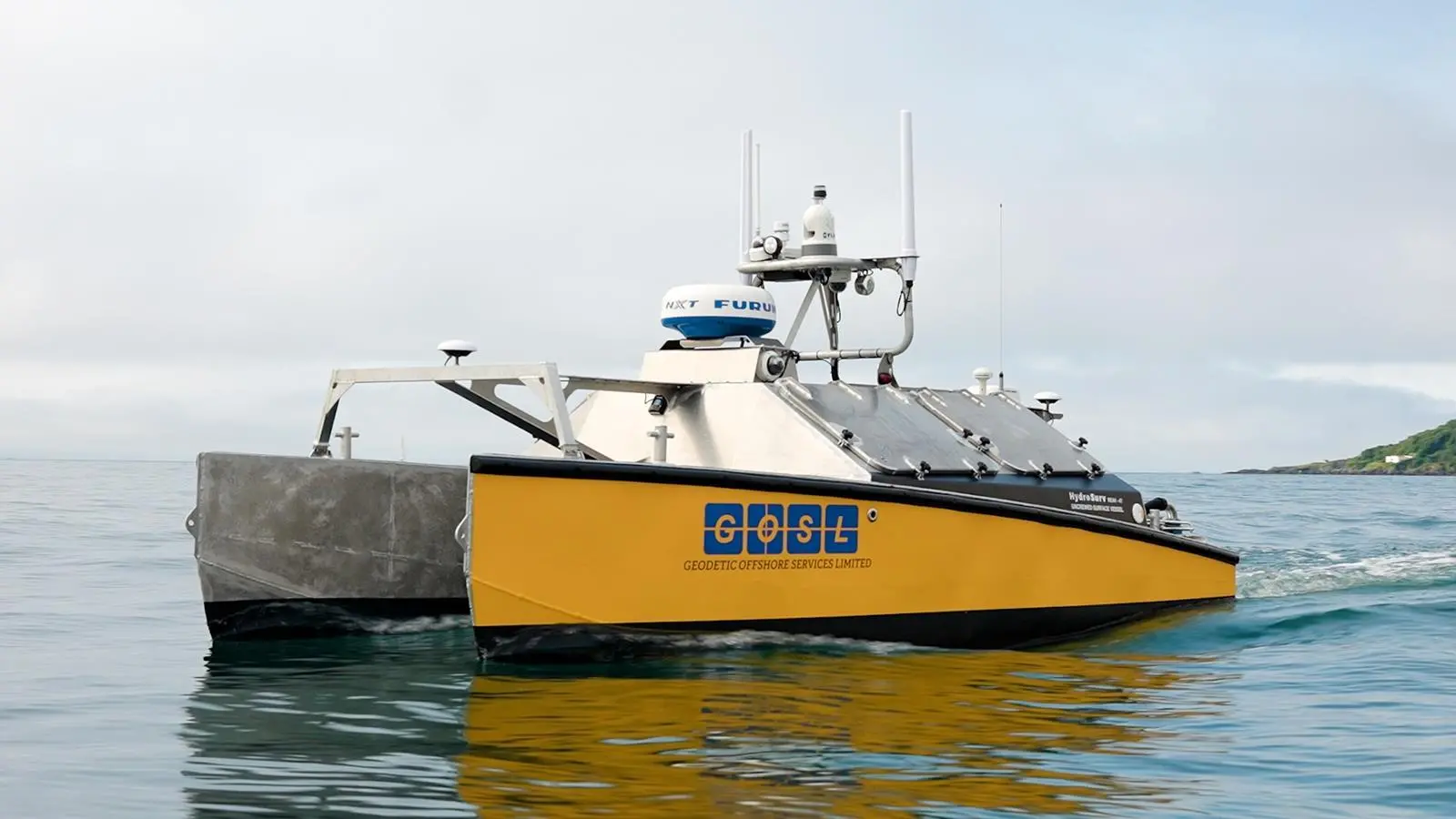
The primary engineering challenge is packaging a relatively large sonar and hydrophone array within the relatively compact 4.5m hull of a HydroSurv REAV-45 USV without compromising vessel operability or data quality.
Crucially, the deployment system must maintain precise and repeatable geometry between transmitters and receivers to support 3D data reconstruction, while remaining compatible with routine launch and recovery procedures and allowing safe access for inspection and maintenance. Positioning tolerances for the array are critical, as small deviations can materially affect data integrity.
For the CUSP project specifically, the REAV-45 incorporates a revised twin steerable pod drive system supplied by Rim Drive Technology. This replaces the previous outboard configuration, simplifying the propulsion installation and improving low-speed manoeuvrability. The vessel’s battery-hybrid power system provides endurance of up to 100 hours between replenishment, supporting extended survey operations without frequent intervention.
The catamaran hullform offers high transverse stability and buoyancy, which is particularly important for maintaining consistent sensor geometry and minimising motion-induced noise during SBP acquisition. This capability builds on the REAV platform’s established use across multibeam, side-scan sonar, parametric sub-bottom profiling, oceanographic profiling and towed magnetometry operations.
In parallel, the data acquisition, navigation, and processing toolchain must be adapted to support synchronised multi-channel acquisition from a surface platform.
This includes ensuring accurate time-stamping, vessel motion compensation and integration with HydroSurv’s vessel control and survey systems. Addressing these challenges holistically is central to delivering a reliable operational capability rather than a one-off demonstration.
Sensor integration
The most important capabilities for a USV-based 3D SBP include stable and repeatable sensor geometry, high positional accuracy, tight integration between navigation and acquisition systems and the ability to operate efficiently in shallow and constrained environments without compromising data quality.
To achieve this, the consortium is iterating on the GeoAcoustics GeoPulse 2’s digital SBP architecture while optimising the transducer and hydrophone geometry for integration with the REAV-45.
Using a field-proven SBP core allows the project to focus innovation effort on the aspects that are genuinely novel, such as the array configuration, deployment mechanics and USV-based acquisition workflows.
Building on decades of SBP development, GeoPulse 2 is a flexible digital platform with high-resolution, shallow and mid-depth capabilities. It supports up to 16 transducers and programmable source signatures including Chirp, CW and Ricker wavelets, and is optimised for precision and adaptability.
In typical seabed conditions, GeoPulse 2 achieves up to 80 metres penetration in fine sediments and 20 metres in sand, with resolution as fine as 6 centimetres.
Project delivery
The CUSP project engineering and integration work is well under way and final selection of the demonstration site is ongoing in coordination with the project’s stakeholder group. Initial trials are expected to take place in the South West of the UK, supported from HydroSurv’s headquarters in Exeter.
While offshore wind remains the primary driver, the capabilities developed through CUSP have broader relevance across offshore energy and maritime security sectors.


