![MaritimeJournal[Seawork]](https://www.maritimejournal.com/wp-content/uploads/2026/09/MaritimeJournalSeawork.svg)



NaviModel software upgraded
Denmark’s Eiva A/S has upgraded its popular 4D data modelling and visualisation tool NaviModel; part of its NaviSuite group of software.
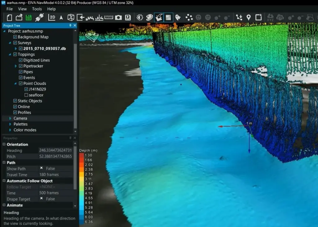
NaviModel is designed to offer subsea survey and engineering professionals an extensive tool for 4D data modelling and visualisation. Features include survey data inspection and eventing, automatic cleaning, video and GIS integration, and point cloud stitching.
NaviModel 4 is available in three different new variants, including a Free Viewer available for download via eiva.com:
-NaviModel Free Viewer: Visualisation of any type of laser or sonar XYZ data: View and navigate data, change visualisation settings, and create a fly-through video of the delivered 3D models.
-NaviModel Producer: The complete solution comprising all the features of NaviModel for data processing, cleaning, modelling and reporting.
-NaviModel Analyser: Basic post-processing and analysis of data.
Raw LiDAR and underwater laser data data, acquired in NaviScan, can now be integrated into NaviModel. In other words, users will be able to apply laser scanner data throughout the acquisition and processing workflow of data from offshore survey operations in all relevant NaviSuite products.
A new intensity control tool enables handling of high intensity values and adjusting settings to match the sensor technology. Thereby, point clouds with high intensity data can now be presented with a much higher level of detail in NaviModel.
An improved imaging feature allows users to drape still images generated from a video or still image camera around a pipe and onto the pipe object during inspection surveys, thereby implementing the video as a 3D object in the DTM.
The result is a digitally generated virtual pipeline that corresponds directly to the exact position on the DTM. Thereby, the software allows for a highly visually realistic representation of the pipeline that is not affected by any data noise or potentially flawed data. Eiva says that this approach combines the best of the two technologies in play: The video data, now draped still images representing the pipeline, can be reviewed much faster, with the DTM providing geocoded data for both the pipeline and the seabed.
By Jake Frith