![MaritimeJournal[Seawork]](https://www.maritimejournal.com/wp-content/uploads/2026/09/MaritimeJournalSeawork.svg)






ATONIS adds data for bright buoys
This month sees the often humble buoy rising in the world of technology as a UK company steps into production of Automatic Identification System (AIS) units that will be fitted to many lighthouse authority marker buoys.
Buoys used to rely on a lantern to show the position of anything from harbour entrances to danger, but the ‘essential’ nature of these navigational aids has long been recognised by the three UK/Ireland lighthouse authorities, providing ‘visual orientation, spatial awareness, and waypoint, channel definition and hazard marking.’
The General Lighthouse Authorities of the UK and Ireland; Trinity House, Northern Lighthouse Board and Commissioners of Irish Lights, have jointly put an order in to Pharos Marine for ATONIS (Aids to Navigation AIS) transponders that will provide data on the functioning and status of buoys and some of the lighthouses under their control, with an option on further meteorological and hydrological information.
Alan Tassell of Pharos Marine said, ‘The tender process was a very detailed one, taking two to three months. Pharos eventually landed the contract through technical capability, experience and price.’ He expects the final volume to be in the order of 200 units.
Part of the difficulty with the process of getting these units agreed, produced and onto the buoys and lighthouses is that ‘experience’ in the area is hard to come by, since although AIS for shipping has been around for the last decade, it is only in the last two years that the technology has been laid down for navigational markers. Mr Tassell adds that ATONIS is both a very big and very new area, ‘one that is destined to grow as it aims to provide the mariner with as much information as possible’.
At its heart, even the most basic of information from the AIS will be invaluable, as it will allow sailors to know that they can trust their charts, that a buoy has not drifted out of its watch circle, and that the light is functioning. The more detailed information from the extra sensors will give them added data, such as wave height and wind speed, in real-time. As part of the IALA Wreck Marking recommendations the ATONIS units will be fitted to the special blue and yellow buoys used for deployment in emergency situations, configured to transmit up to four virtual AIS AtoN Cardinal Marks used around a wreck or new danger.
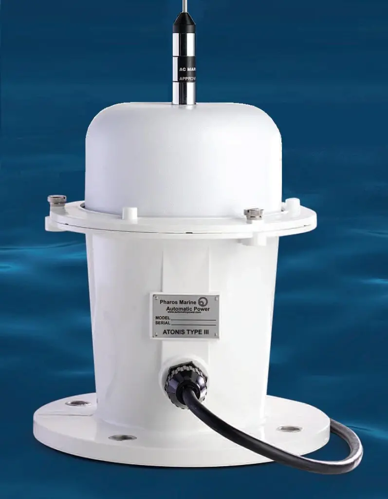
Physically, the unit is quite small, capping the top of the buoy with a box measuring around 300x200x200mm with DGPS and VHF antennae for reception/transmission.
It has a ‘very uninteresting housing’ points out Mr Tassell, meaning that unlike some technological hardware placed on top of buoys, it is not as likely to get damaged by birds or by fishing vessels wanting a good place to tie up.
Related Articles
 VESSELS
 MARINE CONSTRUCTION
 VESSELS