![MaritimeJournal[Seawork]](https://www.maritimejournal.com/wp-content/uploads/2026/09/MaritimeJournalSeawork.svg)




Race to stop coastal collapse enters new heat
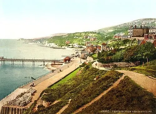
A new phase of ground investigations is getting under way along the Ventnor coastline as specialists gather the evidence needed to shape a long-term defence scheme for the Isle of Wight town.
The work is a key step towards developing the Ventnor Coastal Defence Scheme, a major project intended to address a complex combination of coastal erosion, unstable ground and ageing coastal infrastructure threatening the town.
According to the Environment Agency, the first investigations carried out earlier this summer have already identified problems within parts of Ventnor’s drainage network, where large accumulations of sediment and debris prevented engineers from gaining a complete picture of its condition.
The second phase will have to go considerably deeper: boreholes will be drilled along the seafront to obtain ground samples and identify potential voids beneath the surface, while trial pits on the foreshore will provide further information about the ground and existing structures. The results will help engineers and environmental specialists understand conditions beneath the coastline and determine how future coastal defences can best be designed.
Offshore work
Offshore investigations are also being undertaken, with specialist teams using drop-down video equipment to examine marine habitats along the coastline. The surveys are intended to identify construction and access locations that minimise potential impacts on protected habitats within the Maritime Special Area of Conservation.
Nick Gray, Area Flood and Coastal Risk Manager at the Environment Agency, said the investigations were about establishing the evidence before decisions are made on the town’s future protection.
“Ventnor’s coastline plays an important role in protecting homes, businesses and local infrastructure from the impacts of coastal change,” he said. “These investigations will give us the evidence we need to understand the challenges facing the coastline and develop options that can help reduce erosion risks. It’s an important step towards building a safer and more resilient future for Ventnor.”
We highlighted the scale and complexity of that challenge seven months ago, when we looked at plans for protecting Ventnor from what local authorities have described as potentially catastrophic landslips.
Geography and geology
Ventnor occupies the Undercliff, a roughly 12km chain of ancient landslides extending from Blackgang to Bonchurch. Rather than forming one stable geological slope, the Undercl
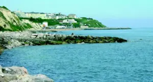
iff comprises multiple deep-seated landslide blocks that can move slowly or episodically.
The town’s geology is central to the problem. Harder layers of chalk and upper greensand sit above weaker gault clay, creating conditions in which the underlying ground can move. At the same time, waves erode the foot of the cliffs, removing support from the base of the slope.
That process, known as toe erosion, is compounded by water entering cracks and weaker layers underground. Increased groundwater pressure can reduce friction and make movement of the slope more likely, particularly following periods of heavy rainfall.
The result is that Ventnor’s coastal defences have a role that goes beyond simply protecting the seafront from waves.
The shoreline provides part of the support for the land on which the town is built. If coastal erosion removes that support, the consequences could extend inland, potentially contributing to further ground movement and damage to properties and infrastructure.
The Isle of Wight Shoreline Management Plan concludes that doing nothing is not a viable long-term option.
Earlier plans include repairs to the concrete esplanade, wave-return walls and rock revetment along much of the existing defence line.
Practical difficulties
The Environment Agency has also identified the practical difficulties of delivering such a scheme.
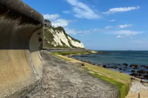
Ventnor is a constrained Ventnor coastline , where investigations continue as part of the Ventnor Coastal Defence Scheme coastal site, with limited access and a high-energy marine environment, while construction will have to consider protected marine habitats. Some of the material required for the eventual works is expected to be delivered by sea.
The scale of the proposed investment reflects the significance of the challenge. The second phase plans are for £150 million works, with the eventual procurement expected to cover a wide range of marine and coastal construction activity, including sea and coastal defence, flood-defence maintenance and breakwater-related works.
The current investigations will help determine how those ambitions translate into an engineered scheme on the ground.
Natasha Dix, Service Director for Waste, Environment and Planning at Isle of Wight Council, acknowledged that the investigations would cause some disruption but stressed their importance.
“These surveys are a crucial step in helping us understand Ventnor’s coastline, giving us the evidence we need to make informed decisions about how best to protect the area, its infrastructure and the communities that depend on it.”
That need for evidence is particularly important in Ventnor because the problem is not simply one of a deteriorating seawall. The coastline, drainage system, marine environment and unstable geology are interconnected, meaning that an intervention designed to solve one problem could have consequences elsewhere if the underlying conditions are not properly understood.
The ultimate objective is to develop a coastal defence scheme capable of protecting the town while working with, rather than against, its exceptionally complicated geological and environmental setting.
There is no single measure capable of resolving the combination of erosion, landslide movement, groundwater pressure and infrastructure instability facing the town.
The second stage of investigations is intended to establish precisely what lies beneath the surface and, ultimately, what will be required to keep Ventnor’s homes, businesses, infrastructure and seafront standing for decades to come.