![MaritimeJournal[Seawork]](https://www.maritimejournal.com/wp-content/uploads/2026/09/MaritimeJournalSeawork.svg)






Unlocking the digital value of hydrographic data
Maritime software solutions provider QPS and marine geo-information specialist TrueOcean are teaming up to digitise the data value process in offshore projects.
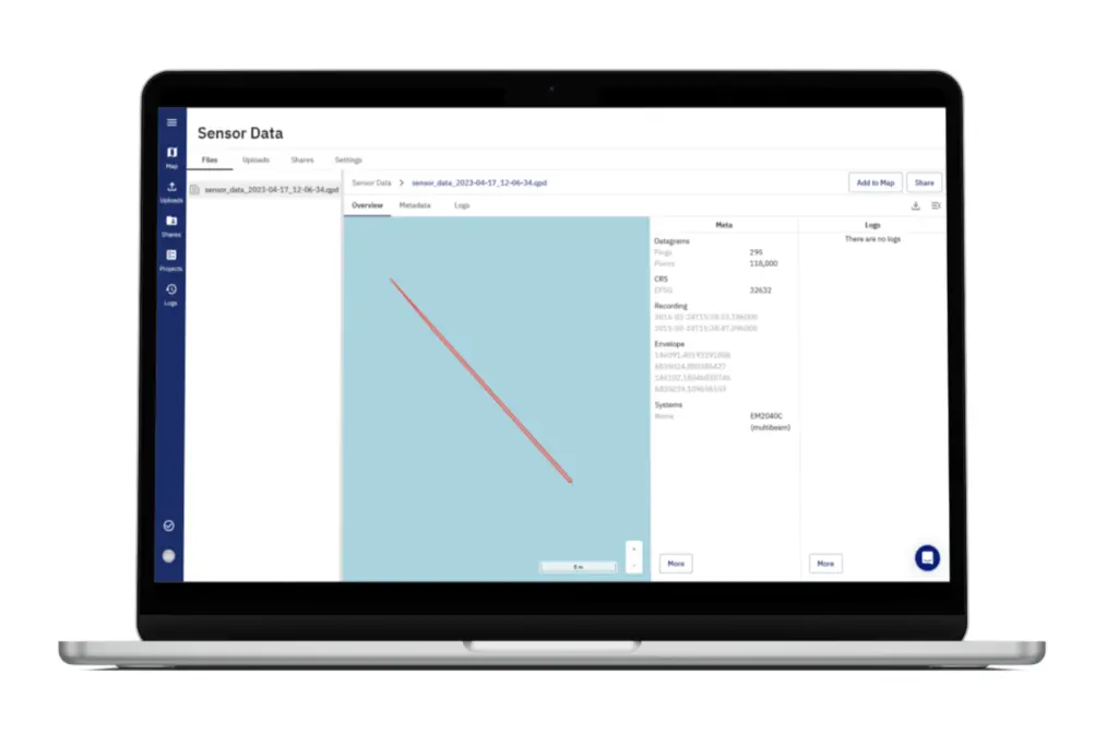
The aim is to develop digital workflows that can optimise the journey of hydrographic data from ping to cloud, by improving on traditional data sharing practices including the use of hard drives or standalone cloud services.
“The demand for offloading QPS proprietary data through a GIS system is growing. QPS sees the need for customers to provide data to their end customers through such platforms and we want to respond to this request from our customers,” said Almar Hollaar, managing director, QPS.
”We want to make it as simple and efficient as possible and provide the best possible solutions to our customers.”
IT integration
The focus is on building seamless integration between industry leading QPS software solutions and the new TrueOcean Marine Data Platform (MDP), with the shared objective of eliminating friction and accelerating data exchange.
This will get information to end users faster by making it possible to directly upload QPS proprietary data to the TrueOcean MDP without data conversion and including valuable meta data from the QPS format. Data can be viewed directly within the platform and extracted into other QPS products for additional analysis.
TrueOcean MDP gives QPS users an intelligent dataspace to store data centrally, securely and at scale, with the added benefit that data has less chance of being lost or corrupted compared to using physical media for storage and sharing.
The platform enables more effective collaboration between internal and external stakeholders while making it easier and faster to access data through unique capabilities such as geospatial searching using a map-based interface.
As a result of the partnership, the QPS .qpd file format will be accessible directly on the MDP, increasing efficiency for users who can quickly get an overview of the content at the touch of a button. This is expected to unlock further efficiencies for hydrographic functions powered by QPS’ software solutions going forward.
“Our joint endeavours will provide solutions to streamline the ability to access value from QPS data by accelerating access and sharing among stakeholders,” said Frithjof Hennemann, CEO, TrueOcean.
“With QPS as a domain partner we merge geo-information and hydrographic functionalities for enhanced data processing features. Verified information will become the key asset and our aim is to make it easily accessible for all project stakeholders without the necessity to be domain experts.”
Related Articles
 OTHER NEWS
 MARINE CIVILS
 MARINE CIVILS