![MaritimeJournal[Seawork]](https://www.maritimejournal.com/wp-content/uploads/2026/09/MaritimeJournalSeawork.svg)






Kotug tests drone towline connection
Dutch towing company Kotug has completed a test run for its Tug Drone project aimed at revolutionising how a towline connection is made between a tug and ship.
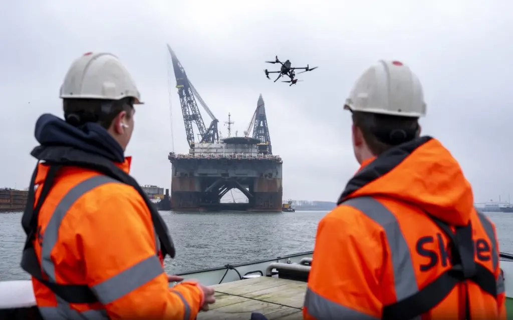
The test has been done in collaboration with aerial survey specialist Skeye.
Connecting a tug and tow traditionally involves a crew member on either vessel casting a heaving line, whereafter increasingly larger messenger lines are hauled aboard the assisted vessel until the towline itself is secured.
Rocket-propelled or pneumatic line throwers are used, for instance in deep sea salvage, but this brings its own risks and is impracticable for day-to-day ship-handling operations.
Using a heaving line requires tug and tow to be in very close proximity to each other, which is particularly hazardous for forward ship-handling tugs that keep pace with the ship close to its bow while under way.
Passing the line requires deck crew to be in the danger zone near the flared bow of the vessel, with risk of injury and damage to both tug and assisted vessel.
Kotug is well known for embracing innovation, and the Tug Drone project, whereby the initial line is transferred to a predetermined location by aerial means, aims to increase the distance between tug and tow, completing the operation in a more controlled way and reducing the risks.
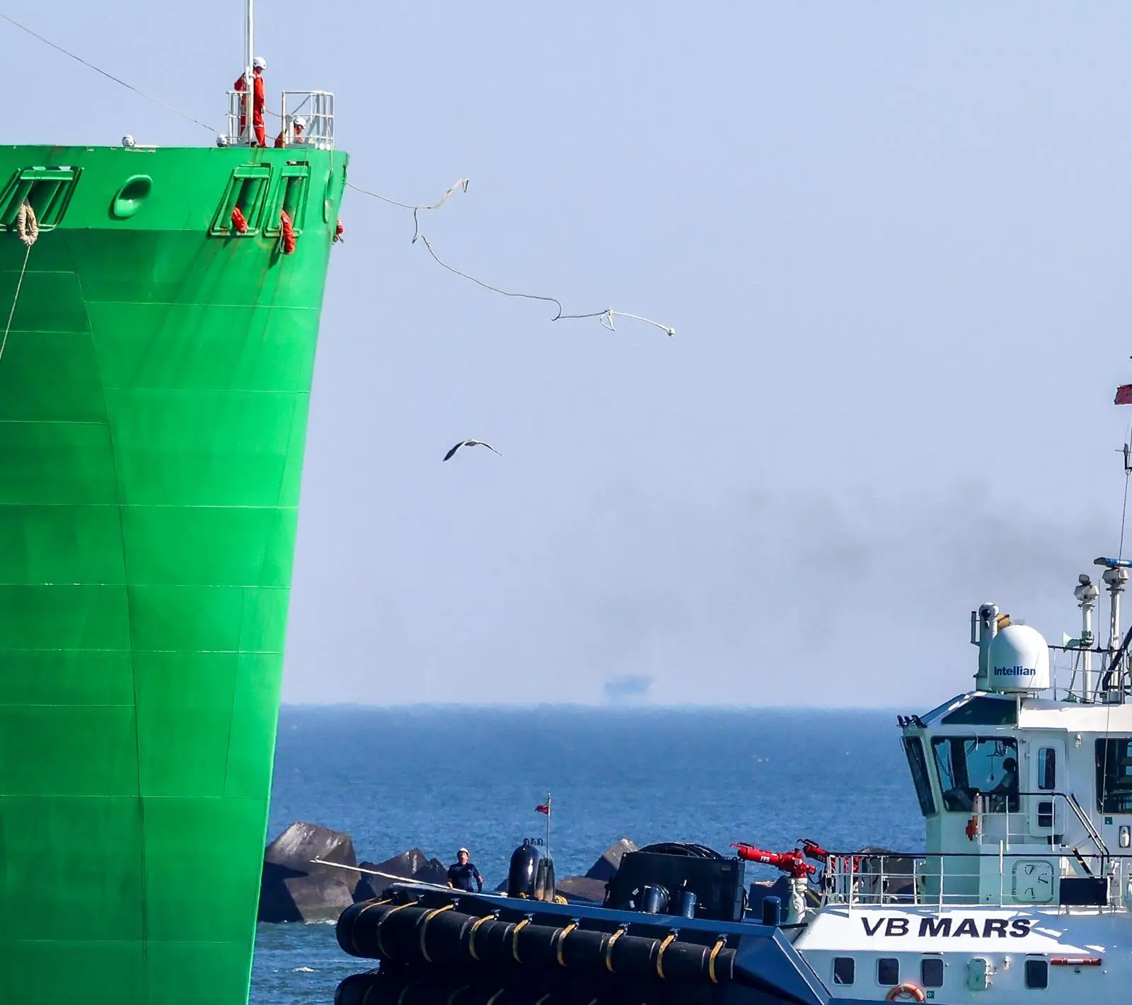
The close proximity of the tug to the assisted vessel is a particularly dangerous part of the process, leaving little or no time to react in the event of the tug losing power or experiencing manoeuvring problems.
“With our innovative technology, the Tug Drone delivers the messenger line directly to the assisted ship, allowing the tug to sail safely alongside rather than in front of the vessel,” says Kotug.
The trial involved transferring a line more than 400 metres from a tug to the helideck of Heerema’s crane vessel Thialf and vice versa. Kotug and Skeye are will embark on the first Tug Drone project in Guyana in Q3 2024.
Skeye has offices in Heinenoord, the Netherlands and Sittingbourne, UK and employs “high-end aerial imagery” providing offshore and onshore survey services.
Related Articles
 OTHER NEWS
 ACCESSORIES & EQUIPMENT
 SPECIAL REPORTS