




Reservoir survey achieved with multiple technologies
A recent survey has been successfully completed using three survey technologies at the same time.
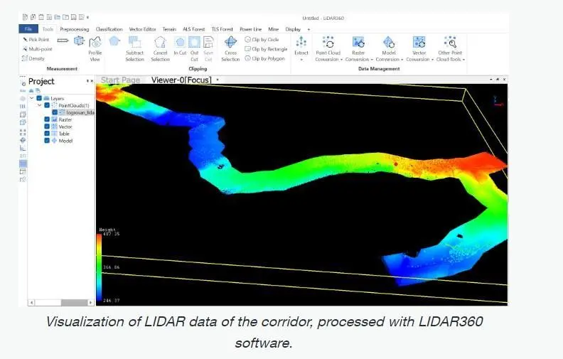
Using drone technology, the bathymetry over an area of nine hectares were surveyed along a 10km corridor of a reservoir in a single day.
Spanish firm Aeromedia, which specialises in aerial surveys, used technology by the Canadian drone technology firm SPH Engineering to survey a 10km-long corridor in the Logrosan-Caceres reservoir in central Spain.
The multiple survey technologies used in combination in the project included an airborne echo sounder system developed by SPH Engineering that is used for terrestrial and underwater terrain.
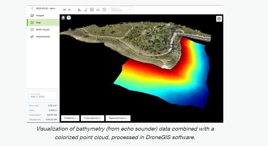
It also used photogrammetry – making measurements from photographs to identify the relative locations of certain points – and LIDAR to look at the topography of a water catchment and discharge area near the Ruecas reservoir.
“LiDAR+RGB techniques were combined in the terrestrial area and the ECT 400S single-beam bathymetric probe in the reservoir area,” says Aeromedia. “The bathymetry of about nine hectares took one day, and the LiDAR flights took one morning. Our client obtained several cartographic products, such as DEMs and point clouds.”
Aeromedia says traditional methods of survey need separate systems for land and underwater, which complicates data integration, and increases time and cost.
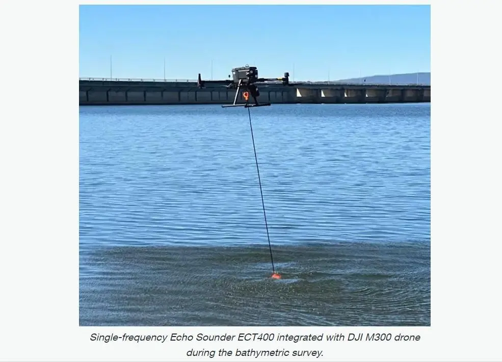
“Moreover, the need to survey under vegetation and achieve depths of up to 100 metres underwater demanded a solution that could provide exceptional precision and versatility,” it says.
Project outcomes
Aeromedia says there were three main benefits from using the three technologies together.
The data collected were accurate and detailed, providing a holistic view of surveyed areas; greater efficiency and cost-effectiveness; and a showcase of how a multi-sensor survey can offer potential for similar technologies ‘to revolutionise the surveying industry, setting a precedent for future projects’.
Related Articles
 MARINE CIVILS
 MERGERS & ACQUISITIONS
 OTHER NEWS