![MaritimeJournal[Seawork]](https://www.maritimejournal.com/wp-content/uploads/2026/09/MaritimeJournalSeawork.svg)





Seabed 2030 maps a new area the size of Europe
The Nippon Foundation-GEBCO Seabed 2030 Project has increased its ocean floor map with 4.34 million square kilometres of new data – or an area the size of the European Union.
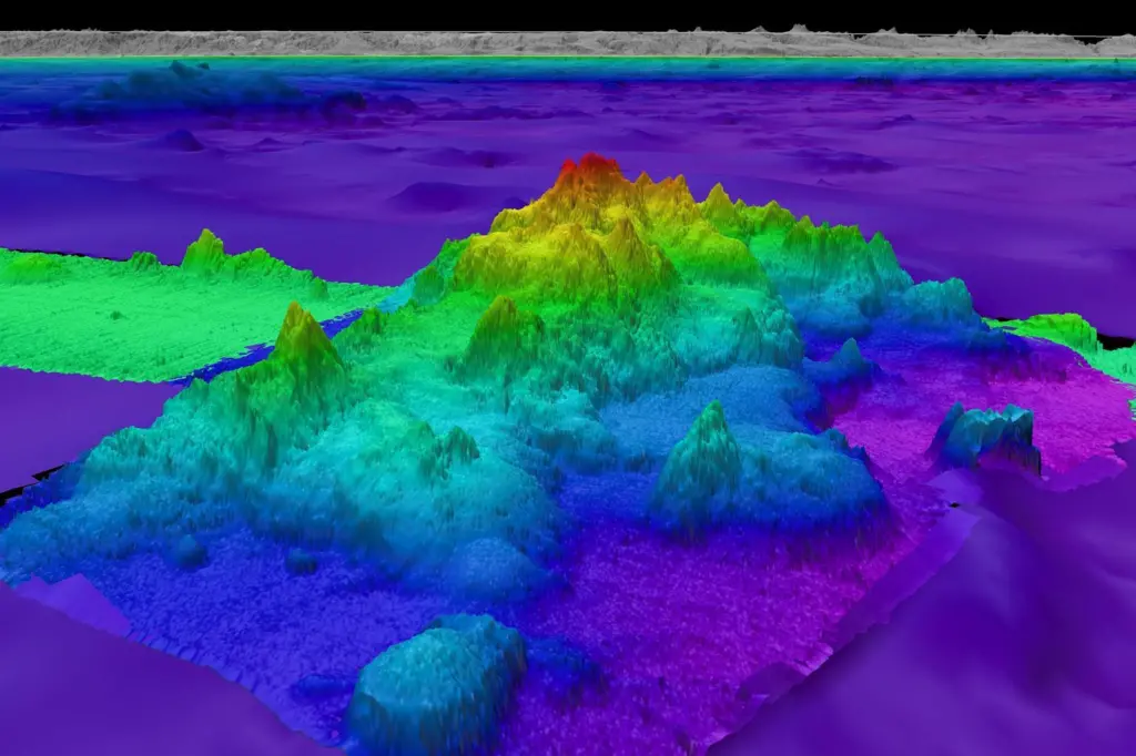
This latest figure of 26.1% mapped is the latest in the global effort to uncover Earth’s final frontier – discoveries that are essential for realising sustainable ocean management.
“Seabed mapping has proven to be a powerful tool in advancing our knowledge of marine ecosystems and biodiversity, and the impressive discoveries made this year alone highlight the critical importance of our mission,” said Jamie McMichael-Phillips, director, Seabed 360.
“Commendable progress has been made since Seabed 2030’s inception in 2017, with over 94 million square kilometres of bathymetric data acquired through global partnerships, data mobilisation, and advancements in technological innovation, but much of the ocean still remains a mystery.”
Pioneering discoveries
In the past year alone, ocean research has led to the characterisation of the largest known deep-sea coral reef habitat off the southeast U.S. coast spanning over 6.4 million acres on the Blake Plateau.
The multi-year campaign to map and explore this region was led by Seabed 2030 partner National Oceanic and Atmospheric Administration (NOAA) Ocean Exploration, in collaboration with a host of other government, academic and private sector collaborators.
Advanced sonar and imaging techniques documented 83,908 coral mounds, showcasing the immense biodiversity previously unknown in this region. This discovery, supported by imagery from 23 submersible dives, highlights the critical role of seafloor mapping in revealing previously unknown aspects of the ocean.
In another remarkable finding, the crew aboard the Schmidt Ocean Institute’s research vessel Falkor made a groundbreaking discovery of four underwater mountains, with the tallest of these standing over 1.5 miles high, using multibeam mapping techniques.
These seafloor features, revealed during a transit from Golfito, Costa Rica, to Valparaiso, Chile, had not been previously recorded in any bathymetric database. Additionally, scientists aboard the Schmidt Ocean Institute research vessel Falkor have identified over 100 potential new marine species during a single deep-sea expedition, highlighting the vast, untapped biodiversity of the ocean.
All data collected and shared with the Seabed 2030 project is included in the free and publicly available GEBCO global grid.
Seabed 2030 is a collaborative project between The Nippon Foundation and the General Bathymetric Chart of the Oceans (GEBCO), with the latter being a joint programme of the International Hydrographic Organization (IHO) and the Intergovernmental Oceanographic Commission (IOC) of UNESCO.
It’s also a flagship programme of the Ocean Decade – a framework to create a sustainable and well managed ocean.

Related Articles
 OFFSHORE RENEWABLES
 OTHER NEWS
 OTHER NEWS