


Devon Develops Emergendcy Marine Planning
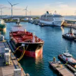
There is a growing awareness of theeconomic and environmental pressures affecting the UKs coastal zone and marineenvironment. Britains coastlinestretches over 17,000 kilometres and is under threat like never before.
The growing demand for and rising price of oil is increasing commercial shipping at UK ports. As a result, an average of 25 to 30 pollution reports are dealt with each month, which largely go unreported in the media. These figures highlight how vulnerable the marine environment is and the need for more sophisticated planning and management regimes.
A key component of emergency planning and delivering better informed decisions is the use of comprehensive marine GIS data. Public sector organisations have traditionally used paper nautical charts, which offer incomplete and out-dated information. Devon County Council is responsible for more than 650km of coastline, excluding estuaries. It is using SeaZone Hydrospatial base reference information to prepare search and rescue, salvage and counter pollution plans.
This base reference dataset is created from authoritative sources such as the United Kingdom Hydrographic Office, at the best available scale level
Simon Wilkins, emergency planner for Devon County Council said, ‘SeaZone has opened our eyes to a new wave of marine geographic information. For too long, we have had to rely on traditional paper charts to understand the sea but SeaZone Hydrospatial represents a 21st Century tool box for effective coastal protection, preservation and management.’
SeaZone Hydrospatial provides more comprehensive information than navigational charts. While only 25% of known wrecks are shown on Admiralty Charts, SeaZone Hydrospatial offers a complete wreck database which helps to identify possible constraints on the seabed, the source of an oil leak or the best evacuation route in the event of an emergency.
In addition to supporting emergency plans, the technology can be used to plan thorough habitat mapping, marine archaeology and environmental measures. With an increasing demand for renewable energy facilities, Devon County Council is planning to use SeaZone Hydrospatial to pursue offshore wind energy opportunities.
The County Council is also leading the trans-national EROCIPS partnership, liaising with 16 European organisations to develop common techniques for marine emergency planning. SeaZone is currently developing relations with government agencies and local authorities across Europe to enable open access to SeaZone Hydrospatial.This will support a truly joined-up approach and deliver the sort of savings and improved decision making that the marine environment so plainly needs.
MJ Information No: 22413
Related Articles
 ACCESSORIES & EQUIPMENT
 ENVIRONMENT
 MARINE CONSTRUCTION