




INSS Data Available
The Geological Survey of Ireland (GSI), in association with the Irish Marine Institute, wants to hear from any company or organisation with an interest in licensing data from the present Irish National Seabed Survey (INSS) project for future development or augmentation of products and services.
Developed to help shipping companies meet Solas carriage requirements for ECDIS, the service combines use of available official Electronic Navigation Charts (ENCs) with Admiralty Raster Charts (ARCs) to provide extensive, seamless digital navigation support.
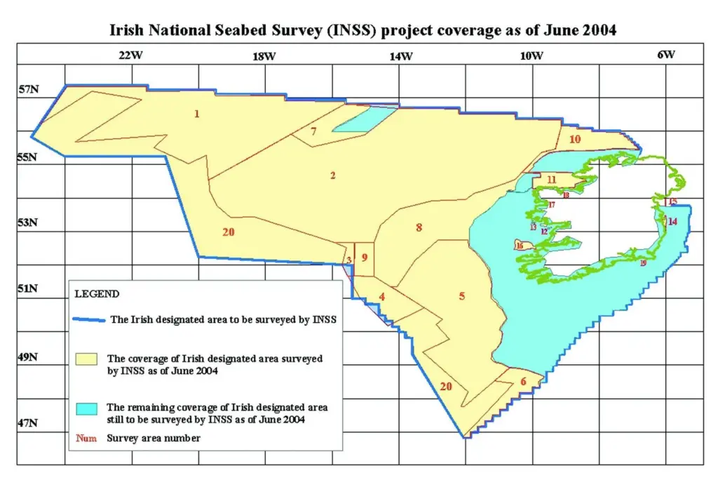
The seven-year 32m INSS project, which began in 1999, is currently the largest hydrographic venture in the world, covering an offshore area ten times larger than Ireland itself. It extends some 1,200km westward into the Atlantic to waters of more than 4,500m depth and is essentially aimed at exploration and development of the Irish Exclusive Economic Zone (EEZ) using mainly two multi-purpose vessels deploying a variety of advanced survey and data processing methods. Latest updates on the project are due to be aired at a free GSI seminar in Galway on 5 November, following The Hydrographic Society’s Hydro4 three-day international symposium.
While the INSS database will remain the property of the GSI, it points out that intellectual property rights for products and services will be retained by developers. A request document and associated files can be downloaded from the organisation’s website (www. gsiseabed. ie).