![MaritimeJournal[Seawork]](https://www.maritimejournal.com/wp-content/uploads/2026/09/MaritimeJournalSeawork.svg)






Yellow River provides murky test for unmanned technology
A recent first full survey of the world’s most sediment laden river has used a combination of unmanned aerial and surface vessels.
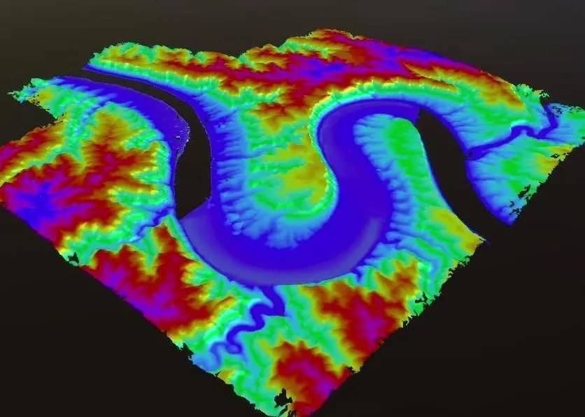
With a total length of 5,464km, the Yellow River is the second-longest river in China. After running through the Loess Plateau in its middle section it becomes the most sediment-laden river in the world. The Yellow river runs through nine Chinese cities affecting the daily lives of the tens of thousands of people who live alongside it.
Monitoring changes in underwater terrain and studying the pattern of river evolution can provide important data support for river management and flood control, to better protect the ecology of the watershed.
However, due to technical limitations and harsh environment conditions, the Yellow River watershed has not been meticulously mapped. The waters are complex with rapid currents and many shallows. With traditional measurement methods, it’s difficult to install survey equipment and rent a suitable workboat. There are also the additional risks to personnel associated with on-water operations.
Recently China’s Second Topographic Survey Team of the Ministry of Natural Resources used intelligent equipment such as unmanned aerial vehicles and unmanned surface vessels to carry out integrated multi-element topographic surveys in the Qiankun Bay section of the river.
The underwater topographic survey was carried out using OceanAlpha’s ME120 autonomous surface vessel platform equipping a multi-beam sounding system.
The ME120 USV adopts a modular design consisting of three pieces that can be quickly disassembled and assembled. It can work automatically and manoeuvre into water as shallow as 0.45 metres.
The transducer and sound velocity meter of the multi-beam system were installed in a lifting apparatus that could be lowered and raised remotely from the shore station. There was no need for personnel to stay on board for retracting operations. This lifting mechanism reduces the risk of equipment damage and better guarantees the safety of personnel.
According to the real-time measured water depth and multi-beam span, the surveyor set up parallel survey lines and inspection lines with the base station software from the dock. The USV navigated according to the survey line instructions, and the collected data was sent back to the shore-based control terminal in real-time.
The collected data delivered a high quality reflection of the topography of the river. The ME120 USV was also equipped with a high-precision inertial navigation system, which provided strong support for the seamless splicing of multi-beam data and UAV data. After analysis and processing of both data streams, the team obtained high-quality integrated above water and underwater data of the Qiankun section.
OceanAlpha Group., Ltd. is a world leading commercial unmanned surface vehicles (USV) manufacturer, headquartered in Hong Kong, China. OceanAlpha has grown from a single small office in 2010 to a workforce of over 300 employees today, with over 110 R&D engineers and holds 92 USV related patents.
By Jake Frith


