![MaritimeJournal[Seawork]](https://www.maritimejournal.com/wp-content/uploads/2026/09/MaritimeJournalSeawork.svg)



Subsea tunnels and terminals: Shetland approves 30 years of works
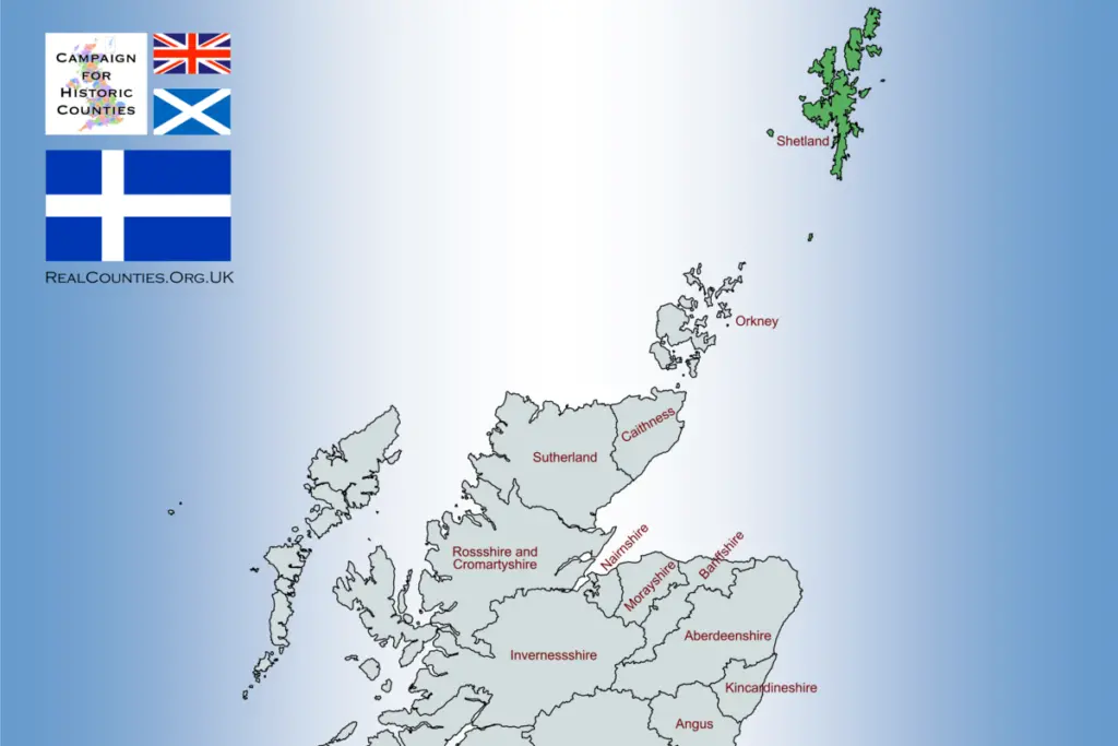
A 30-year programme of marine engineering works has been approved to connect three of the UK’s most remote islands.
There are only 22,700 people on the islands, which are dominated by open moorland, peatland, grassland and exposed coastal terrain and hardly any trees.
At a Shetland Islands Council meeting this week, councillors approved plans to dig a subsea tunnel between Shetland’s Mainland and Yell and another between Yell and Unst.
Yet the tunnels – the former estimated at 6.8km in length and the latter around 4.35km – are only part of the extensive three-decade programme of works.
Fixed links with new ferries and a rolling programme of harbour and ferry terminal reconstruction, refurbishment, dredging and maintenance will also be needed along with finger-pier replacement, linkspan works and ground investigations, all while the logistical requirements of building tunnels in remote North Atlantic conditions are tackled.
The council has indicated that the tunnels will be built concurrently, with the Mainland to Yell first. It means that one could be completed and operational by 2034, the second, shorter one by 2036.
Both tunnels would be dug around 50km beneath the seabed.
Conventional tunnelling
Initial proposals envisage conventional hard-rock subsea tunnelling, like the Channel Tunnel, as opposed to immersed tubes, like the Fernmanhelt Tunnel between Denmark and Germany, which is currently being built.

Previous work has considered gradients of around 6%, while more recent geological work has examined gentler gradients.
The programme calls for business-case development, ground investigation and design before construction. The route map explicitly identifies ground investigation as a separate stage, alongside outline and final business cases, tendering and building.
This means a sizeable front-end market involving marine and terrestrial geotechnical surveys, geological mapping, boreholes, seismic surveys, environmental surveys and access works.
Once tunnelling begins, the likely equipment spread would be dominated by drill-and-blast excavation equipment, rock bolting and support systems, ventilation, dewatering and muck-handling systems, with substantial surface plant at the portals.
The Faroe Islands provide a useful regional comparator. Their recent subsea tunnels were constructed using conventional drill-and-blast techniques, with tunnelling carried out in hard rock beneath the sea.
The remoteness of the Shetland Islands will present other challenges in getting heavy plant, materials, fuel, personnel and prefabricated components to the work sites themselves.
“We have made our position clear today, and with the support of the Scottish and UK Governments we could be driving through tunnels in Shetland in as little as eight years from now,” said council leader Emma Macdonald after the meeting. “Islands with fixed links repopulate, enjoy economic growth and experience a reduction in their average age.
“The most critical consideration now is to continue to look at potential external funding, and our team will report back on that, alongside the draft Implementation Route Map.
“We have no ‘do nothing’ options here. Ferries and tunnels are both needed to unlock the potential of Shetland, and both the Scottish and UK Governments have a vested interest in helping that happen.”
Depending on final construction methods, the works are likely to need workboats, barges, landing craft or other cargo vessels for the movement of plant and materials, as well as survey vessels and marine access arrangements.
New ferries – new terminals
As well as the subsea links, surface links via ferries are still part of the plan, with continued investment in ferry services and eight new inter-island ferries. The existing fleet is ageing, with the council identifying vessel condition, infrastructure condition and vehicle-deck capacity as the main drivers for capital investment.
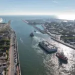
Whalsay is an island community in the east of Shetland served by ferry connections from two mainland terminals at Laxo and Vidlin. Symbister, on Whalsay, is the island’s principal settlement and harbour and provides the main focal point for ferry and maritime activity.
Planned improvements to the Whalsay ferry service will need upgrading the ferry network in its entirety and not just the vessels.
At Laxo and Vidlin, the proposed works are understood to involve reconstruction or substantial upgrading of existing facilities to accommodate larger vessels.
This could mean modifications to berthing infrastructure, linkspans, approach alignments, manoeuvring areas and terminal layouts, together with any associated dredging or strengthening works.
At Symbister, the programme identifies a potentially more significant intervention involving the conversion of the Pelagic Basin into a ferry terminal capable of accommodating larger vessels. Such a scheme would represent a substantial change to the existing harbour configuration and would need assessment of berth geometry, navigational access, water depth, structural capacity, passenger and vehicle handling arrangements and interfaces with the surrounding road network. It would also need to consider the implications for existing commercial and fishing activity within the harbour.
Dredging and linkspans
Dredging will be need at the ferry terminals of Hamars Ness, Belmont and Gutcher, with recurring maintenance dredging appearing at some sites later in the programme and likely to be extended well beyond the initial construction phase.
Depending on quantities and environmental constraints, the eventual work could involve backhoe dredgers, excavators, barges, split-hopper or other material-handling arrangements, survey boats and support craft.
The programme also explicitly identifies linkspan refurbishment and replacement at life expiry, likely involving structural steelwork, hydraulic or mechanical equipment, bearings, ramps, electrical systems and marine civil works around the landing structure.
At Skerries, the existing finger pier is already identified as approaching the end of its life and requiring replacement.
At Bressay, infrastructure is showing signs of deterioration, while replacement is expected in the medium term. At Foula, infrastructure at Hamars Ness is expected to require replacement in the 2030s, with ongoing maintenance at Walls.
These projects are individually much smaller than the tunnels, but collectively they form a substantial programme of marine asset renewal.
A 30-year work bank

The Council describes the IITCP as a roughly 30-year programme running to 2057, designed to take the network through a complete cycle of asset replacement. It will operate through a rolling five-year Capital Investment Planning Pipeline, beginning in 2027.
The timeline consequently contains work at different levels of maturity: some projects are e
ntering business-case development; others move into ground investigation, final business cases, tendering and construction; still others appear as longer-term maintenance or replacement requirements.
However, the works will not come cheap, and the council has said the pace of delivery will depend on the funding.
In a first step, the Scottish government has confirmed that it will fund business case and pre-construction work to begin on the Mainland-Yell tunnel.
Compared with Europe’s biggest subsea tunnels, the individual Shetland crossings are not record-breakers.
Norway’s Ryfylke Tunnel is 14.3km long and reaches 292m below sea level, while the Faroese Eysturoy and Sandoy tunnels are 11.2km and 10.8km respectively.