![MaritimeJournal[Seawork]](https://www.maritimejournal.com/wp-content/uploads/2026/09/MaritimeJournalSeawork.svg)






Digital boulder detection boosts marine survey
Coda Octopus has launched a groundbreaking upgrade enhancing hydrographic survey, seabed mapping and marine navigation efficiency.
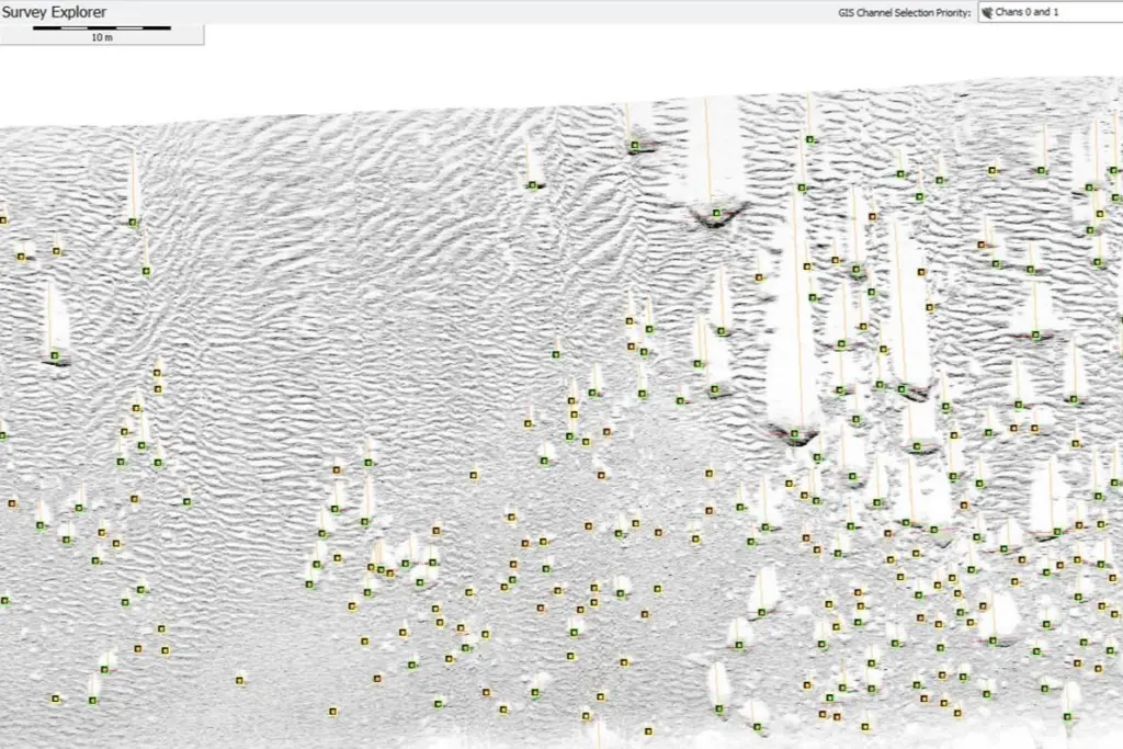
Survey Engine Automatic Detection Package (SEADP) Version 4.1 release is a retrained machine learning model, dramatically improving automated boulder detection in diverse marine environments.
“We’re excited to deliver a model that identifies up to 65% more boulders in complex seabeds without sacrificing speed or accuracy,” said a Coda Octopus spokesperson.
“This advancement reshapes how survey teams approach seabed mapping projects.”
Precise mapping
The new SEADP upgrade offers not just precise boulder locations and dimensions but also provides snapshots and confidence scores for each detection.
This digital survey tool processes hundreds of kilometres of sonar data in minutes, a task that once took geophysicists weeks.
Enhanced quality control tools allow surveyors to review, deduplicate and filter results efficiently, ensuring only accurate data is included in final reports.
Thanks to its user-configurable outputs, SEADP seamlessly exports essential features like boulder positions, route offsets and confidence levels across multiple formats, supporting a wide range of marine navigation and seabed mapping needs.
With SEADP Version 4.1, Coda Octopus said it is looking to solidify its leadership in marine technology innovation, pushing the boundaries of automated seabed analysis and paving the way for faster, more precise marine navigation projects.
Related Articles
 OTHER NEWS
 MARINE CIVILS
 MARINE CIVILS