




Dunkirk shipwrecks pictured in new 3D images
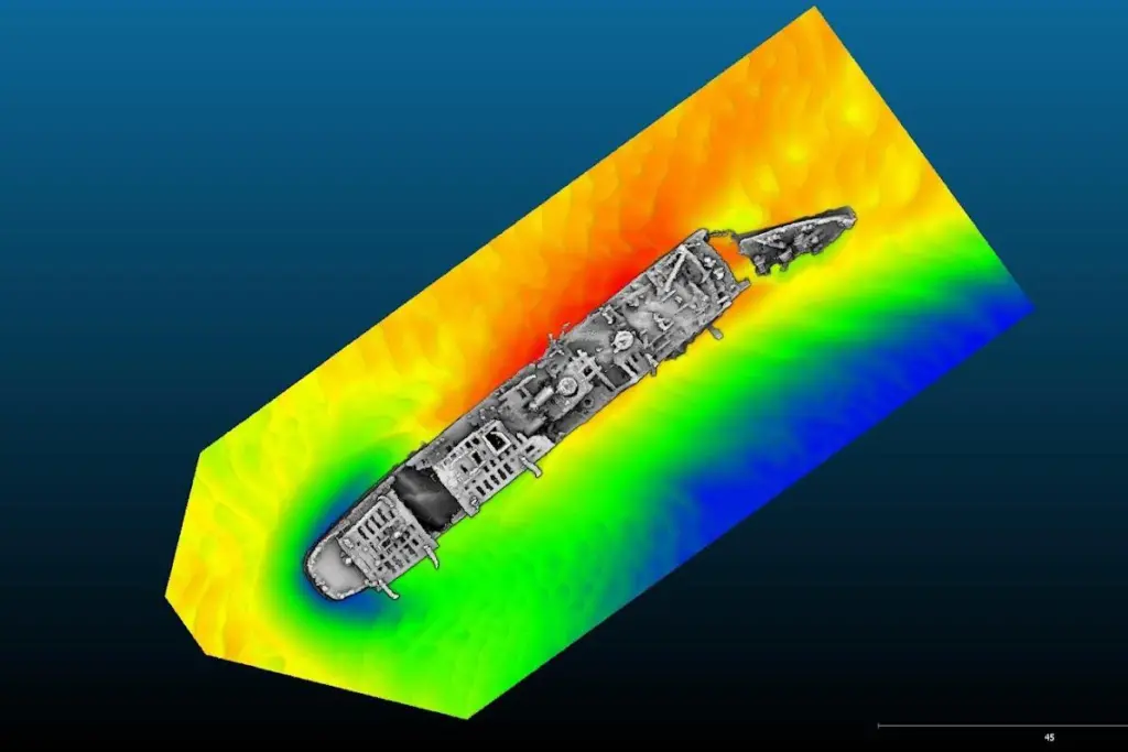
Remarkable 3D imagery has been published showing precise details of ships wrecked as they tried to evacuate troops from Dunkirk during World War II.
’Operation Dynamo’ was a mass deployment of between 1,000 and 1,500 of every kind of vessel imaginable, from military ships to tugs and fishing boats, to France, where French, British and Belgian troops had been encircled by the German army.
Almost 340,000 soldiers were crammed into the rescue vessels over nine days, and the ones being sought are some of the more than 300 that were bombed by the Germans and sank.
Today’s images have been able to correct some misidentification of the vessels lying on the seabed, such as the mine sweepers Denis Papin and Moussaillon, which had been confused, says Historic England, which co-led the survey work alongside French government-owned archaeologist agency Drassm and MSDS Marine, a British hydrographic survey and archaeological services firm.
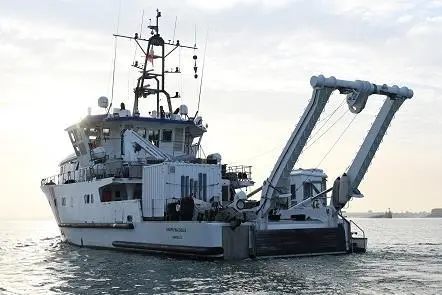
The key piece of equipment that collected the data from which the images were created was an R2 Sonic 2024 multibeam echosounder mounted on the hull of the survey and research vessel André Malraux, which is owned by Drassm. It sends out a fan of sound that is recorded as it bounces off the seabed. The data can then be used by geophysicists to create a 3D image, and this was done by UK archaeological firm MSDS Marine.
MSDS operations and technical manager Mark James accompanied the two Drassm archaeologists Cécile Sauvage and Claire Destanque on the three-week voyage of discovery.
“At MSDS Marine we normally work on very old wrecks where there isn’t so much left on the seabed,” he said. “So this was quite different, quite phenomenal to see things like the propellers showing up.”
The vessels were found in a wide range of depths, all of more than 10 metres.
Although the approximate location of most of the wrecks was known, 12 were unclear and four have not been found.
“A further 19 features have been studied, three of which appear to correspond to the location and characteristics of vessels lost during Operation Dynamo that were previously undiscovered,” says Historic England.
“It’s very moving to see new details emerge from 30 shipwrecks linked to Operation Dynamo for the first time since the events at Dunkirk during the Second World War,” said Duncan Wilson, chief executive of Historic England.
“We’re pleased that a geophysicist from the UK, commissioned by Historic England, has been integral to the survey that has successfully captured these details alongside Drassm’s incredible team of scientists. The results give us a striking insight into our shared heritage that still lies beneath the waters off Dunkirk.”
The survey operation was carried out between September 25 and October 8,
You can see more 3D images and other photographs here.
Related Articles
 MERGERS & ACQUISITIONS
 OTHER NEWS
 ENVIRONMENT