![MaritimeJournal[Seawork]](https://www.maritimejournal.com/wp-content/uploads/2026/09/MaritimeJournalSeawork.svg)






Seabed 2030 expands Arctic seabed mapping
The Nippon Foundation-GEBCO Seabed 2030 Project has released Version 5.0 of the International Bathymetric Chart of the Arctic Ocean (IBCAO), significantly enhancing seabed mapping coverage.
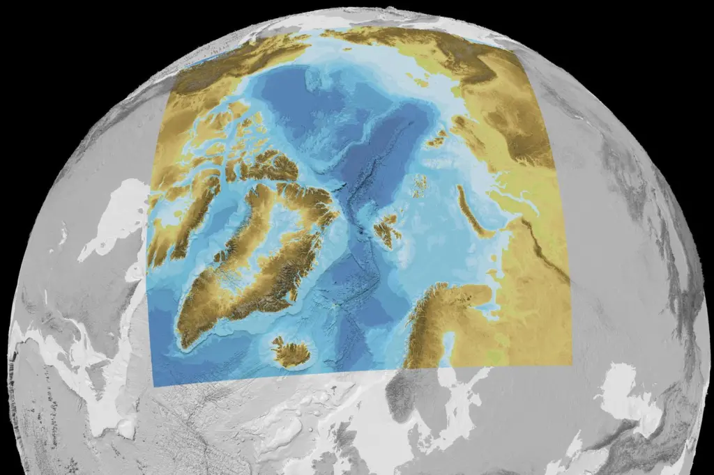
This new hydrographic survey data will add 1.4 million square kilometres of subsea mapping, advancing global efforts for a fully mapped ocean floor by 2030.
“The release of IBCAO Version 5.0 is a testament to the collaborative effort of the Arctic research community and our dedication to overcoming the challenges posed by the extreme Arctic environment,” said Martin Jakobsson, co-head of Seabed 2030’s Arctic and North Pacific Regional Center.
Unprecedented coverage
This latest version, published in Scientific Data by Nature, increases mapping resolution to 100 x 100 metres, offering an unprecedented level of detail for hydrographic surveys in the Arctic.
The newly added coverage spans an area more than three times the size of Sweden, improving navigation safety and subsea exploration.
Overcoming challenges posed by Arctic sea ice, the project leveraged advanced cloud-based computing and metadata integration to compile the dataset. These innovations enable more accurate seabed mapping, supporting global marine research, resource management and environmental protection.
Seabed 2030 project director Jamie McMichael-Phillips has spoken about the broader impact of the project.
“This release underscores the importance of regional initiatives like IBCAO in helping us achieve our goal of a fully mapped ocean floor by 2030.”
All collected data is now freely available through the GEBCO global grid, contributing to the future of sustainable ocean exploration and maritime safety.
More detailed information on The Nippon Foundation-GEBCO Seabed 2030 Project is available from https://seabed2030.org/
Related Articles
 OTHER NEWS
 MARINE CIVILS
 MARINE CIVILS