




Garmin relief shading coverage goes global
Garmin International’s high-resolution relief shading coverage has been expanded to countries in Europe and Australasia.
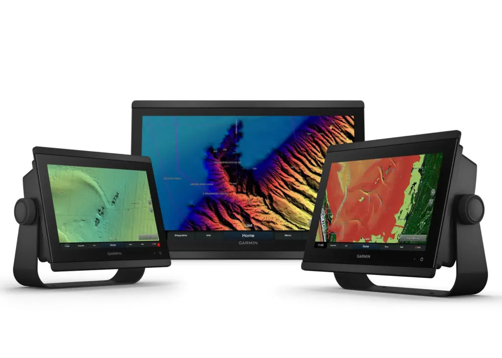
Coastal boaters and anglers in the UK, Ireland, Belgium, France, Germany, Norway, the Netherlands, and New Zealand and Australia, can now download relief shading chart content to exclusive BlueChart g3 Vision cartography products for an easy-to-interpret, clear view of the ocean floor.
“We remain committed to delivering the most detailed, accurate charts and maps for all of our customers across the globe, which is why we are pleased to offer high-resolution relief shading for our customers in Europe, New Zealand and Australia,” said Dan Bartel, Garmin vice president of global consumer sales.
Multidimensional illustration
Relief shading combines rich colour and shadow, created from multibeam surveys and high-definition data, for a multidimensional illustration of bottom structure. Customers can download high-resolution relief shading directly to BlueChart g3 Vision cards, via the ActiveCaptain app.
Premium BlueChart g3 Vision cards offer a full suite of Garmin’s latest g3 cartography, including features like blended Garmin and Navionics data and content, built-in Auto Guidance1 technology, and unique 3-D views.
By Rebecca Jeffrey
Related Articles
 OTHER NEWS
 ACCESSORIES & EQUIPMENT
 ACCESSORIES & EQUIPMENT