


Hydrographic Survey – Page 43
-
 News
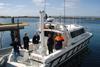
NewsSee a Seawork winner in action
Johnson Outdoors UK will be at Seawork 2009 showing a range of marine products on Stand S52. Also to be seen on the floating pontoon’ s Berth A54, where on the water demonstrations will be taking place, is the Side Imaging Sonar from Humminbird was one of the outstanding products ...
-
 News
NewsGeoSwath doubled for shallow water surveys
Two GeoSwath wide swathe bathymetric sonars are being used for regular hydrographic port surveys around the South Australian coast, providing bathymetry and side scan data for use in the development and maintenance of this important national infrastructure.
-
 News
NewsROVing the depths
Coral, never before seen in colour and fish never seen alive or in their natural habitat have been filmed by a Saab Seaeye Falcon DR ROV in an expedition to discover new coral communities deep in the Gulf of Mexico.
-
 News
NewsWideband multibeam for nearshore survey
Kongsberg Maritime has released what it says is the world' s first true wide band high-resolution multibeam.
-
 News
NewsVeripos anniversary move
Veripos, now claiming to be the world’ s second largest supplier of satellite based positioning services to the world offshore industry in a market estimated to be worth at least € 2bn, has marked its 20th anniversary with a move to new premises in Westhill, Aberdeen. Its new headquarters include ...
-
News
Icelandic AUVs for NCS Survey
NCS Survey, also of Aberdeen, has acquired two Gavia type AUVs from designers Hafmynd of Reykjavik in Iceland under a contract worth some $1m. Both swath bathymetry configured systems include GeoSwath sonars and other sensors and have a depth rating of between 200m and 1,000m.
-
News
NetSurvey buys further Seabat sonars
In a deal concluded at last month’ s Ocean Business 2009 event in Southampton UK, Banbury based NetSurvey has ordered two SeaBat 7125-SV dual head multibeam sonar systems from Reson of Denmark.
-
News
Introductory hydrography course
Specialist course organisers Skilltrade BV of Holland are holding a beginners seminar at € 750 per head for anyone interested in hydrography, at the Fastolff Business Centre, Great Yarmouth on 26 and 27 May.
-
News
Valeport warranty scheme
Valeport in Totnes, one of the UK’ s leading manufacturers of hydrographic and oceanographic instrumentation, is now in its 40th year and has launched a new perpetual warranty programme covering any of its products.
-
News
World Hydrography Day
With the third annual UN decreed World Hydrography Day due on 21 June, the intergovernmental International Hydrographic Organization in Monaco has announced this year’ s theme as ‘ Hydrography - Protecting the Marine Environment’ .
-
 News
NewsNew Saab ROV development
Pioneering technology at Saab Seaeye in Fareham, Hampshire UK has resulted in what is claimed to be the world’ s most advanced electric work class ROV, which will significantly reduce operating costs by accelerating the shift from hydraulic to electric work ROVs for many more applications.
-
News
Norway to provide updated charts on demand
The Norwegian Hydrographic Service (NHS) in Stavanger plans to introduce a ‘ Print on Demand’ facility for its updated charts, beginning next year.
-
News
Geoswath multibeam systems for Rijkswaterstaat
GeoAcoustics of Great Yarmouth, which was acquired by Kongsberg Maritime last autumn for a reported £ 4.3m, has delivered four of its GeoSwath multibeam systems to the Rijkswaterstaat (RWS), the arm of the Dutch Ministry of Transportation & Water Management responsible for construction and maintenance of national waterways and flood ...
-
News
Teledyne acquires Odom Hydrographic Systems
Teledyne Technologies in the US, which last year bought TSS’ s inertial sensing systems business in Watford UK, has been on the takeover trail again with news that it has acquired Odom Hydrographic Systems of Baton Rouge, Louisiana for an undisclosed sum.
-
 News
NewsTritech launches low cost sonar
A plug and play hull mounted towfish sidescan sonar less than 15 inches in length and costing just £ 1,699 has been launched by Tritech International of Aberdeen UK.
-
News
Partners sought for Irish ROV development
Prospective partners are sought for continuing refinement and development of Rovlatis, a new generation ''smart'' ROV constructed for international marine applications by the University of Limerick''s Mobile & Marine Robotics Research Centre (MMRC).
-
News
Damen Dredging - Trimble OEM agreement
Damen Dredging Equipment of Nijkerk in the Netherlands and Trimble Europe have signed an OEM agreement under which the Dutch company will fit Trimble positioning systems to its standard range of cutter suction dredgers and associated instrumentation and automation products.
-
 News
NewsGIS solutions for Marine Bill requirements
Marine geographic information solutions provider SeaZone is offering a ready made information solution to help organisations affected by the UK government''s Marine and Coastal Access Bill.
-
 News
NewsDigital mapping for Marine Protected Area planning
ABP Marine Environmental Research (ABPmer) has been awarded a major contract to develop digital mapping / spatial information layers that will help identify Marine Conservation Zones (MCZs) in UK waters.
-
 News
NewsEMGS launches world's first EM survey vessel
Electromagnetic Geoservices ASA (EMGS) of Trondheim, Norway has launched the world''s first purpose built EM survey vessel, Boa Thalassa to enhance its global hydrocarbon exploration activities.