![MaritimeJournal[Seawork]](https://www.maritimejournal.com/wp-content/uploads/2026/09/MaritimeJournalSeawork.svg)




Key role for ABPmer in Wallasea Island project
ABP Marine Environmental Research Limited (ABPmer) has played a lead role in the Environmental Impact Assessment and Planning Application submission work for the RSPB’ s Wallasea Island Wild Coast Project in the UK.
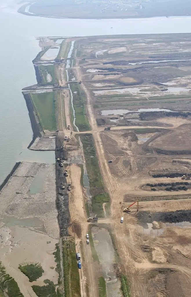
The application for this project was submitted to Essex County Council at the end of November 2008.The project will involve the use of earth removed during the building of the £16bn Crossrail project to reshape the landscape of Wallasea Island, near Southend-on-Sea. The landscaping will allow the creation of a new coastal nature reserve through managed realignment.
The proposed scheme will create new wildlife habitats in phases over about 10 years. This will include making gaps in the sea walls to allow seawater to flow in and out with the tides, similar to those on the adjacent 115 hectares of ‘managed realignment’ carried out by DEFRA in 2006.
Having been claimed from the sea in the 13th/14th centuries and after hundreds of years of subsequent settlement and manipulation by man, almost all of Wallasea Island now lies well below high tide level. Simply letting the sea in would bring in too much water and would cause problems with navigation, fisheries and erosion elsewhere in the adjacent Crouch and Roach Estuary system. Raising the land levels therefore addresses this issue by reducing the volume of water that will be exchanged with these estuaries after realignment. It also avoids the risks associated with a future unmanaged flood event if no intervention takes place.
The project will be the largest wetland scheme of its type in Europe. The application area covers 677 hectares within which 133 hectares of mudflat and 276 hectares of saltmarsh will be created. The creation of these new habitats will contribute to relevant Biodiversity Action Plan (BAP) targets and will help to offset historical losses of mudflat and marsh.
By virtue of its scale, the project involved a very detailed scheme design process which was pursued collaboratively between RSPB, ABPmer and Faber Maunsell. During this process ABPmer’s modelling and GIS teams played a key role in understanding how the scheme could be created, how it will function, how much imported earth was required and, crucially, what effect it will have on the designated habitats, fisheries interests and sailing/navigation activities in the Crouch and Roach. The GIS team also created a 3-D visualisation of the scheme to describe how it will look and how the water will flow across and through the site. This output will be very important for the detailed public consultation which RSPB are now undertaking.
Essex County Council is expected to reach a decision on the project in the spring of this year. The work on Crossrail, which will connect Maidenhead in Berkshire to Shenfield in Essex via Heathrow and central London, will begin from 2010. The boring of tunnels for the rail project will begin in 2011 and the work on the island habitat is expected to take up to 10 years.


