![MaritimeJournal[Seawork]](https://www.maritimejournal.com/wp-content/uploads/2026/09/MaritimeJournalSeawork.svg)






Precision seabed ploughing monitoring for Cork
A project that has allowed Ireland’s Port of Cork to precisely monitor and record the winter programme of seabed ploughing in real time for the first ever time is being delivered by Succorfish in partnership with Irish marine communication specialists SEA-Tech.
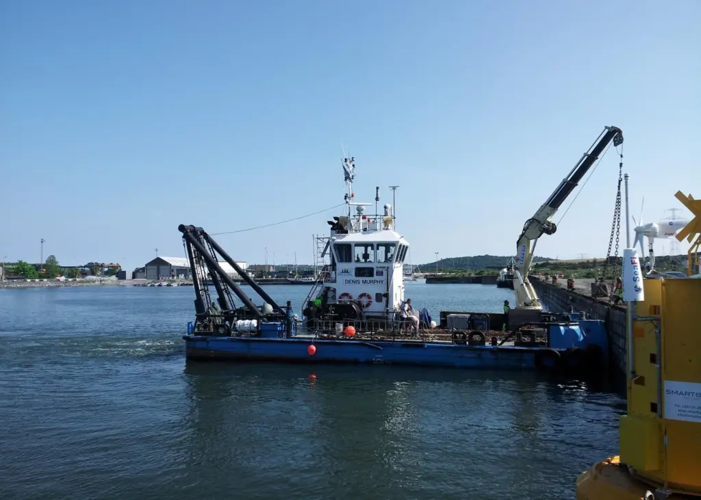
The groundbreaking exercise, which is being carried out aboard a utility vessel working to lift sediment from the port seabed into the water column and back out to sea, sees live, up to the minute and highly valuable location data transferred back to officials instantly in real time. And, given its success, it is anticipated that it could change the way future ploughing operations are carried out as well as greatly improve efficiency for the world’s second largest natural harbour.
Succorfish is a provider of intelligent M2M data transfer technology, next generation telematic communication systems and GSM/GPRS asset tracking products. It has installed its SC2 vessel monitoring unit and RFID winch sensors aboard MV Denis Murphy, a 20m multicat type utility vessel used for maintenance duties, including bed levelling and oil pollution response.
Over six months, Port of Cork and SEA-Tech personnel will have the ability to accurately record vessel movement more frequently and in real time, and analyse activity as it happens from specific harbour areas using the system’s innovative ‘geofence’ facility.
Succorfish head of marine Tom Rossiter says: “The Port of Cork project is significant, as the technology used has the potential to change operational methods and increase efficiency here and at similar ports worldwide. Never before has activitiy such as ploughing been accurately mapped onshore at the same time as it is being carried out on the vessel and this will be beneficial for future planning as well as day to day operations of the port.”
The SC2 monitoring unit uses GPRS/GSM technology and Iridium satellite eporting as well as bespoke online software to offer the marine industry a complete low cost solution. Its sector specific features include e-log data reporting, SOS emergency alarm, anti hijack alert, radio frequency identification (RFID), crew safety systems and also deep sea thermal sensor attachments for fishing.
The system installed aboard the MV Denis Murphy also offers 100% data security and allows users to access their own information via a password protected online interface. Critically, and as well as Iridium satellite reporting, this information is available via mobile devices, allowing users to monitor progress whilst on the move. The RFID scanner fitted to the heavy duty winches also demonstrates the SC2’s ability to monitor activity remotely across all areas of the vessel’s operations.
Another proven feature is the geofence facility that manages access to certain areas and alerts the operator by email or text whenever a vessel enters or exits such waters. It is currently used successfully by fishery managers in the UK to monitor marine protected areas to two metres accuracy and gives operators an exceptional level of confidence in knowing the exact location of their vessel at any given time.
Related Articles
 INSURANCE, LEGAL & FINANCE
 EQUIPMENT
 EQUIPMENT