![MaritimeJournal[Seawork]](https://www.maritimejournal.com/wp-content/uploads/2026/09/MaritimeJournalSeawork.svg)






Successful trials for survey USV
A new Unmanned Surface Vessel (USV) for inland waterways surveying has demonstrated a capability to follow pre-programmed survey missions while streaming live survey data to create accurate bathymetries in shallow-water or hazardous environments.
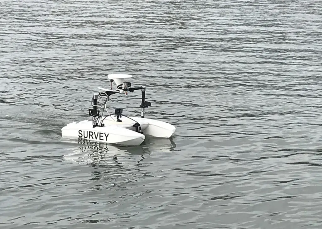
Developed by Safeguard Nautica in collaboration with Regyar, the ‘micro Rapid Environmental Assessment Vessel’ (mREAV) with automated swathe following and station-keeping features has completed initial trials in the South West of England, where it was operated in still water environments and in high-current estuaries. It was verified in high-current environments, streaming live data to the operator onshore.
Reygar managing director Chris Huxley-Reynard said: “The unmanned vessel can be fitted with a variety of survey equipment, allowing it to map factors such as bathymetry, river flow rate, water quality and temperature – making it particularly ideal for organisations responsible for environmental monitoring, as well as ensuring safe navigation for inland vessels such as canal users.”
Precise control
The vectored-thrust propulsion system offering precise control and redundancy, draws upon Reygar’s previous experience in developing dynamic positioning systems.
Safeguard Nautica’s director, David Hull, said the trials provide a pathway to low-cost survey acquisition for contingency assignments worldwide or for waterborne site investigators.
Designed to be compact, the USV can be carried in small vehicles or as civilian aircraft luggage. Safeguard Nautica worked with Dr Rachel Nicholls-Lee to develop an optimised hull form which reduces flow disturbance in way of the survey payload. The result is a sensor platform less than 1m in length and weighing less than 20kg.
By Rebecca Jeffrey
Related Articles
 INSURANCE, LEGAL & FINANCE
 EQUIPMENT
 EQUIPMENT