![MaritimeJournal[Seawork]](https://www.maritimejournal.com/wp-content/uploads/2026/09/MaritimeJournalSeawork.svg)






Further work to manage marine historical environment
Hampshire UK based underwater specialist SeaZone has been commissioned to characterise archaeological potential for shipwrecks by the University of Southampton (UoS).
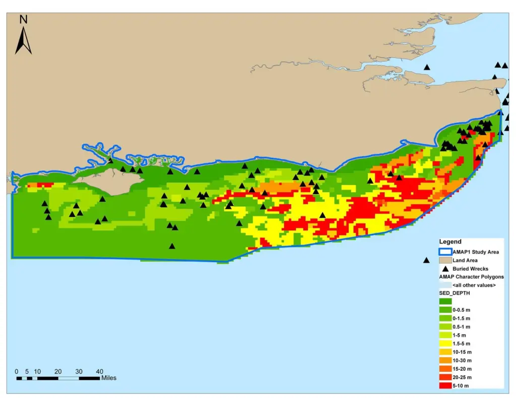
The ‘AMAP2 – Characterising the Potential for Wrecks’ Project (AMAP2), commissioned in October 2009, is a collaborative project between SeaZone and UoS which seeks to improve the management of the marine historic environment through the interoperability of reference and archaeological data for marine spatial planning.
The aim of the project is to study relationships between the survival of shipwrecks and the natural environment. The results will be used to develop a characterisation of areas of maritime archaeological potential (AMAP) based on the environmental parameters affecting the survival of wrecks in seabed sediments, thus providing the basis for a more justified assessment of potential for unrecorded wrecks.
Following the success of the AMAP1 pilot project in 2008, the AMAP2 project seeks to further the monitoring, mitigation and management of the marine environment for offshore industries such as renewable energy and marine aggregates by facilitating the assessment of potential threats to archaeological assets.
Improving the understanding of the relationships between wrecks and their environment, coupled with the results of seabed modelling undertaken by UoS will provide a firm basis for interpreting the variables which affect the potential for wrecks to survive in different seabed conditions.
The creation of a GIS-based characterisation of the archaeological potential for shipwrecks and the consequent enhancement of data, core to the aggregate licensing process, will enhance the approach to marine spatial planning and benefit the marine industry as a whole.
The project will make best use of SeaZone HydroSpatial to develop a characterisation of the variables affecting the potential for archaeological materials to exist and survive on the sea bed. The ability to access bathymetry, sea bed geology, as well as wrecks and obstructions data, from a single consistent source and associate it with historical NMR data is of great value to this and any future projects where there is a need for cross disciplinary analysis.
SeaZone will use in-house expertise in maritime archaeology, GIS and data management, plus staff experience in developing the concept and methodology for AMAP1, to undertake this project in close collaboration with UoS and English Heritage.
SeaZone and UoS believe the project will help build firm foundations for future marine planning and research, promoting consistency, and encouraging the enhancement and interoperability of digital marine data.
Related Articles
 OTHER NEWS
 MARINE CIVILS
 MARINE CIVILS