



Saildrones for survey
In September, scientists from the USA’s National Oceanographic and Atmospheric Administration (NOAA) will launch two Saildrone sail powered unmanned systems from Alameda, California, on a six-month, 8,000 nautical mile round trip mission to the equator and back to improve the Tropical Pacific Observing System (TPOS).
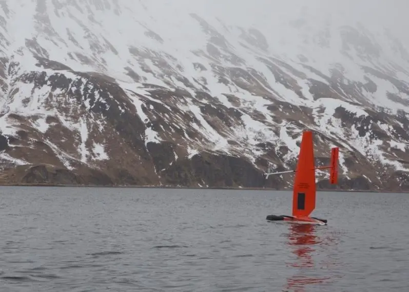
The autonomous vessels are trimarans, powered by wing sails. The Saildrone wing technology was evolved over a 10 year period, driven by the research of Saildrone founder Richard Jenkins as he battled to break the wind powered, land speed record. He ultimately achieved that record in 2009 (126.2mph) before applying the wing technology to an unmanned sailboat, which became Saildrone.
The quest for speed and control, led to the innovation of a precise but low-power wing system that makes the Saildrone possible.
TPOS provides real-time data used by the US and partner nations to forecast weather and climate, including El Nino. The unmanned sailing vehicles will take part in a larger field study with NASA, and visit mooring sites along the array of observing buoys. “Saildrones can do adaptive sampling like research ships, but at a fraction of the cost,” says Meghan Cronin, PMEL oceanographer. “We’ll be testing whether this new, enhanced tool can provide a suite of measurements at a quality that matches research ships and proven mooring technology. If this is the case, they may become a powerful tool to provide key observations for weather forecasts.”
NOAA’s PMEL began a partnership with Saildrone, Inc. in 2014 through a Cooperative Research and Development Agreement to develop unmanned surface vehicles that collect high quality oceanic and atmospheric observations. NOAA’s PMEL provides engineering expertise on sensors and sampling techniques and Saildrone, Inc. provides unmanned system hardware and software expertise.
In mid-July, NOAA scientists sent off Saildrones from Dutch Harbor, Alaska, with two sailing north through the Bering Strait into the Arctic Ocean and another transiting the Bering Sea. Traversing Alaska’s inhospitable waters, the remotely-operated vehicles tracked melting ice, measured the ocean’s levels of carbon dioxide, and counted fish, seals, and whales to better understand their behaviour and populations.
For the first time, the vehicles journeyed through the Bering Strait into the Arctic with a newly adapted system to measure CO2 concentrations. “We want to understand how changes in the Arctic may affect large-scale climate and weather systems as well as ecosystems that support valuable fish stocks,” said Jessica Cross, an oceanographer at NOAA Research’s Pacific Marine Environmental Laboratory (PMEL), who is using the unmanned system to study how the Arctic Ocean is absorbing carbon dioxide.
By Jake Frith