





Dutch coast ‘stabilised’ with beach nourishment
Dutch coastal towns and infrastructure have been protected ‘for the coming years’ after extensive sand replenishment works
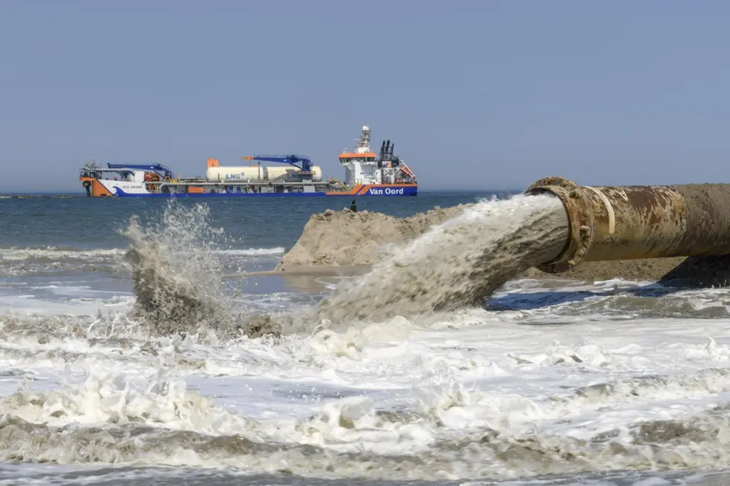
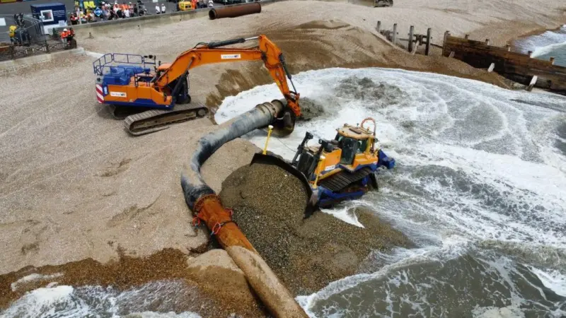
Marine contractor Van Oord deployed all three of its new suction dredgers – Vox Apolonia, Vox Alexia and Vox Ariane to dredge around four million cubic metres of sand from the seabed and pump it through a pipeline to the beach, where the firm says weather and wind will ensure it spreads further to form sand dunes.
“In this way, the coast is being reinforced with the help of nature’s own forces,” it says. “At the Oostgat shipping channel, the channel wall was replenished, i.e. the channel just offshore was partly backfilled with sand. Because the channel is now not as close to the shore, less sand disappears from the beach and the coastline stays in place longer.”
The work has been done under the Coastline Care programme of Rijkswaterstaat, the executive agency of the Dutch Ministry of Infrastructure and Water Management.
According to the European Space Agency, large parts of the Zeeland region, around 150km from the Dutch capital of Amsterdam, are below sea level, making it more at risk from flooding.
“The province was the site of a deadly flood in 1953 brought on by a combination of high spring tides and a strong wind storm that severely damaged the low-lying coastal region,” it says.
“As a result, the Dutch government began to implement the Delta Project – an elaborate system of dykes, canals, dams and bridges to hold back the North Sea. A 9km-long Eastern Scheldt Storm Surge Barrier (Oosterscheldekering) was built between the islands of Schouwen-Duiveland and Noord-Beveland.”
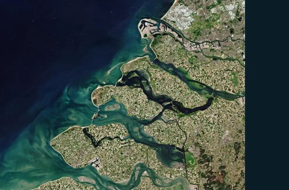
Zeeland comprises many islands, peninsulas and waterways, and lies on a large river delta at the mouth of several rivers, with Europe’s largest seaport, Rotterdam, just to the north.
Zeeland is also an important agricultural region, with a patchwork of fields growing cereals, potatoes, beets and rearing livestock.
Related Articles
 MARINE CONSTRUCTION
 MARINE CONSTRUCTION
 MARINE CONSTRUCTION