


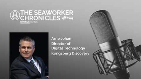
On the eve of Oceanology International (OI), which is being held in London on March 10-12, Digital Technology director Arne Johan spoke to Maritime Journal about what it plans to unveil at the event, its strategies and its eyes in space.

You can hear what he had to say in our podcast, or read the interview below.
Underwater awareness
OI, which Maritime Journal will be attending, has traditionally been a launch platform for Kongsberg’s newest developments, and this year is no exception.
Among the highlights is a new high-resolution sonar system designed to combine advanced hydroacoustics with underwater autonomy, with an emphasis not only on seeing further, but seeing more clearly.
“Having good navigation is very key to us in the subsea environment,” says Johan. “It’s always been GPS denied. We also see this increasingly in other areas where managing poor connectivity and poor positioning is important. I think we’ll have some engaging things for people at OI around navigation.
“The security sphere is also going to be an important topic this year – we will bring some solutions and systems that we’re pulling together to give a better situational awareness of what’s happening around us, how can we integrate all data.”
Advances in onboard data processing now allow the system to extract features previously hidden in acoustic returns. Subtle anomalies, small objects and fine seabed structures can be identified more effectively, a major advantage in environments where security concerns are rising and subsea infrastructure is under increasing scrutiny.
Pipelines, cables, offshore wind foundations and critical energy assets require continuous monitoring. Detection is no longer limited to scouring or seabed change; it increasingly includes identifying foreign objects or potential threats.
“More security-related object detection capabilities are important – where it was pipeline surveying for a long time, now we’re also looking for objects,” he says. “We also need to look after the infrastructure that we have in the water to a whole different level than we have had to do before.”
Autonomy for longer range
In a GPS-denied environment, the challenges of required longer missions, deeper deployments and reduced reliance on support vessels are immense.
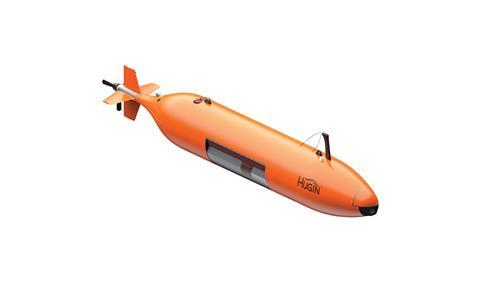
When it comes to endurance – some vessels can stay out for several weeks – it hasn’t just been the improvement of battery technology that has enabled it, but improved navigation.
By combining motion reference units with acoustic systems, the company has improved drift management over extended deployments, allowing autonomous underwater vehicles (AUVs) to remain submerged for up to 16 days, travelling more than 2,000 kilometres.
The objective is fully autonomous operation with minimal infrastructure dependency — avoiding the need for seabed transponders or frequent recalibration.
Communication, too, is evolving. Kongsberg has developed acoustic modems capable of transmitting video subsea.
“We have two major areas where we want to excel and that’s having long, robust operations, so the AUVs know where they are and can operate for a long time and provide lots of data per hour.
“But we are also looking into how we can get more detail per mission, So it’s a balancing act — bringing the range up and the resolution down.”
Letting a load of AUVs loose subsea isn’t always without risk – Johan admits one has been lost while surveying the underside of icebergs in the Antarctic.
“They were doing increasingly aggressive surveys and for many days got very good data back – but then eventually it was too aggressive and they lost it,” he says. “We are happy to announce that they bought a new one.”
Data, climate and the bigger picture
Beyond commercial operations, Kongsberg Discovery’s technology is playing a growing role in environmental and climate research.
The company is involved in the deep-sea mapping initiative Seabed 2030, which aims to produce a complete map of the world’s ocean floor. Coverage currently stands at roughly 30%, highlighting both the progress made and the work still to be done – and Johan believes other subsea technology companies should join the effort.
In the Arctic, long-term stationary monitoring systems are gathering temperature and current data to better understand climate dynamics in a basin where water circulation takes decades. “So we can learn the changes that are coming to the rest of the world by looking into the Arctic,” he says, “and together with the EU, we have done some really nice static monitoring systems. We have large subsea stations looking at how the climate is changing, how the temperature is changing, what’s really happening with the world and the ocean currents.”
Sometimes the technology reveals the quite unexpected.
In one marine sanctuary survey in Norway, an AUV deployment discovered 36 undocumented shipwrecks in a single day.
“We dug into a few of them because they looked very interesting,” Johan says. “And we were also curious why there were so many wrecks in this area.
“It turned out to be an area where the current and the wind turn really hard, and if the vessels were poorly loaded they would tip over and sink. In one of the areas we found lots of oil barrelsin various states of decomposition.”
Chasing stars: Kongsberg Discovery’s next giant leap
In many ways the subsea environment is very similar to outer space.
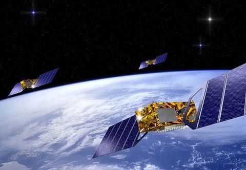
Where below the waves, currents affect a vessel’s motion, in the world above, orbital dynamics can alter a spaceship’s trajectory. In both scenarios estimations and corrections have to be done at all times. There’s also the range of sensor and radar equipment vital for accurate navigation, with GNSS and inertial systems vital.
So it should come as no surprise that Kongsberg Discovery is setting its sights on the big beyond, already being Europe’s largest satellite manufacturer, according to Johan, who says corporate restructuring has now brought space, surveillance and subsea capabilities under one umbrella.
The idea is to bridge the data gap between space and subsea and link global satellite awareness with ultra-high-resolution ocean intelligence.
“I think it might be surprising to people that we are stepping up in this game and making both space sensors and space satellites themselves,” he says. “I think these are exciting times for us and I think it complements the very high-resolution data we get from our subsea equipment, with a global situational awareness that you can get from space.
“Maybe we’re talking about what’s happening in the future, right? The ability to create ocean missions based on what you see from space.”
For a company long associated with hydroacoustics, AUVs and navigation systems, this expansion into space is a logical next step in a strategy built around data – how it is gathered, fused, interpreted and acted upon across domains, from orbit to ocean floor.
In a maritime world facing geopolitical tension, climate fears and infrastructure expansion, the demand for precise, reliable, multi-domain intelligence has never been greater.
From space to subsea, the company intends to deliver exactly that.